 Stevens Pass... Summit @ Sno... Summit @ Sno... Summit @ Sno...
 Bogus Basin
  BOGUS BASIN Updated Oct 02 @ 11:00


 WebCams

Coaster
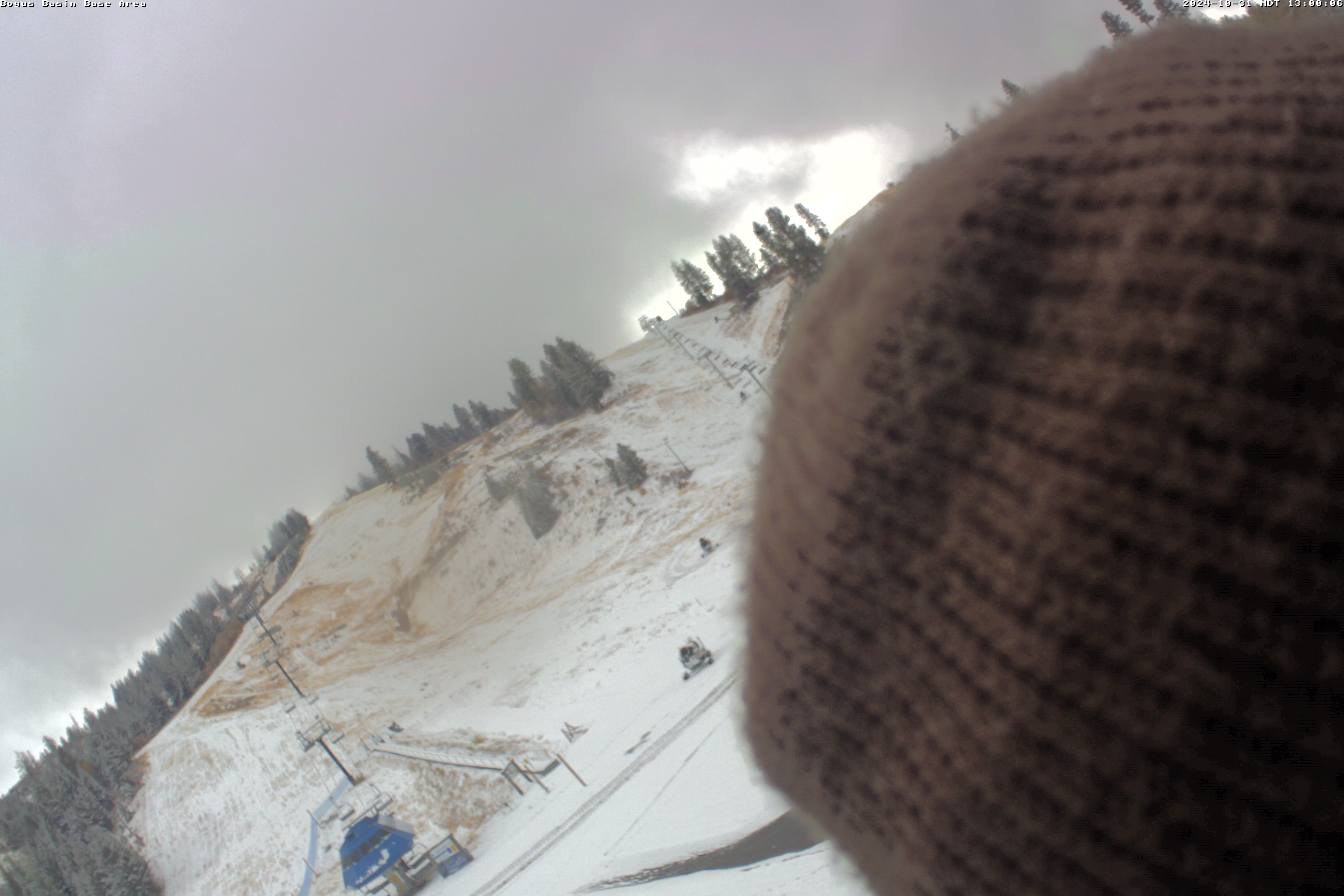
Base Area
Snow Stake
SUNDAY
May 5

33° / 26°

7 - 15
mph
 4
4
MONDAY
May 6

34° / 23°

17 - 28
mph
2
TUESDAY
May 7
30° / 20°

13 - 22
mph
1
WEDNESDAY
May 8
37° / 32°
14 - 23
mph
0
THURSDAY
May 9

46° / 39°
5 - 13
mph
0
FRIDAY
May 10

51° / 47°
5 - 13
mph
0
SATURDAY
May 11
51° / 50°
7 - 15
mph
0
Cloudy becoming mostly cloudy at times continuing through overnight, colder. Periods of snow are expected at any time, most steady and heavy in the morning.
Periods of snow, lighter overnight. Snowfall is forecast to be 3 to 5 inches.
Potential Precip:
0.28 to 0.55, 80% chance
Hi: 33°Low: 26°
5,045 feet to 6810 feet
Winds variable at 6 to 14 mph in the morning, becoming variable at 4 to 12 mph in the afternoon, and then W at 9 to 17 mph with gusts to 24 overnight.
Mostly cloudy becoming cloudy at times and then mostly cloudy overnight. Periods of snow are expected at any time.
Light snow during the day, becoming moderate in the evening through overnight with periods of heavy overnight. Snowfall is forecast to be a trace amount during the day, and 3 to 6 inches in the evening and overnight.
Potential Precip:
0.12 to 0.58
Hi: 28°Low: 22°
5,045 feet to 6810 feet
Winds variable at 8 to 16 mph in the morning, becoming W at 10 to 19 mph in the afternoon, and then W at 16 to 27 mph overnight.
Mostly cloudy through the day and overnight, cold, with periods of snow expected at any time.
Periods of snow. Snowfall is forecast to be 2 to 3 inches.
Potential Precip:
0.13 to 0.34, 60% chance
Hi: 34°Low: 23°
3,741 feet to 6625 feet
Winds SW at 12 to 21 mph in the morning, becoming NW at 13 to 22 mph in the afternoon, and then W at 12 to 21 mph with gusts to 28 overnight.
Mostly cloudy becoming cloudy at times and then mostly cloudy overnight. Periods of snow are expected at any time.
Heavy snow during the day, becoming moderate in the evening through overnight with periods of heavy overnight. Snowfall is forecast to be 4 to 6 during the day, and 4 to 7 inches in the evening and overnight.
Potential Precip:
0.2 to 1.01
Hi: 28°Low: 17°
3,741 feet to 6625 feet
Winds W at 18 to 29 mph in the morning, becoming NW at 24 to 35 mph in the afternoon, and then NW at 20 to 31 mph with gusts to 38 overnight.
Mostly cloudy and cold, with periods of snow expected in the morning through overnight, mostly light.
Periods of snow. Snowfall is forecast to be 1 to 2 inches.
Potential Precip:
0.08 to 0.25, 50% chance
Hi: 30°Low: 20°
2,932 feet to 6267 feet
Winds NW at 23 to 34 mph in the morning, becoming W at 8 to 16 mph in the afternoon, and then variable at 5 to 13 mph overnight.
Cloudy becoming partly cloudy in the evening continuing through overnight, with periods of snow expected in the morning through overnight.
Snowfall is forecast to be 1 to 2 during the day, and a trace amount overnight.
Potential Precip:
0.03 to 0.14
Hi: 25°Low: 22°
2,932 feet to 6267 feet
Winds NW at 31 to 42 mph in the morning, becoming NW at 17 to 28 mph in the afternoon, and then NW at 10 to 18 mph overnight.
Cloudy becoming partly cloudy at times continuing through overnight. Periods of rain and snow are expected overnight.
Periods of light snow throughout the day. Snowfall is forecast to be a trace amount.
Potential Precip:
0 to 0.02
Hi: 41°Low: 36°
6,781 feet to 8309 feet
Winds N at 10 to 19 mph in the morning, becoming S at 10 to 19 mph in the afternoon, and then variable at 6 to 14 mph overnight.
Cloudy becoming partly cloudy at times continuing through overnight. Periods of snow are expected in the morning through overnight.
Periods of light snow throughout the day and overnight. Snowfall is forecast to be a trace amount.
Potential Precip:
0 to 0.02
Hi: 34°Low: 28°
6,781 feet to 8309 feet
Winds N at 12 to 21 mph in the morning, becoming N at 13 to 24 mph in the afternoon, and then variable at 9 to 17 mph overnight.
Partly cloudy becoming mostly clear at times and then clear overnight. Periods of rain are expected in the morning.
No snow.
Potential Precip:
0.02 to 0.11
Hi: 51°Low: 44°
8,030 feet to 9433 feet
Winds variable at 3 to 11 mph through the day, becoming variable at 6 to 14 mph overnight.
Partly cloudy becoming mostly clear at times and then clear overnight.
Periods of snow throughout the day and overnight.
Potential Precip:
0.02 to 0.11
Hi: 41°Low: 34°
8,030 feet to 9433 feet
Winds variable at 7 to 15 mph with gusts to 27 through the day, becoming variable at 8 to 16 mph overnight.
Partly cloudy becoming mostly clear at times continuing through overnight.
No snow.
Potential Precip:
0 to 0.02
Hi: 56°Low: 48°
10,062 feet to 10271 feet
Winds variable at 5 to 13 mph through the day, becoming variable at 3 to 11 mph overnight.
Partly cloudy becoming mostly clear at times continuing through overnight.
No snow.
Potential Precip:
0 to 0.02
Hi: 46°Low: 43°
10,062 feet to 10271 feet
Winds variable at 4 to 12 mph through the day, becoming variable at 4 to 11 mph overnight.
Mostly cloudy becoming clear at times continuing through overnight, with periods of rain expected in the morning through evening.
No snow.
Potential Precip:
0.12 to 0.62
Hi: 56°Low: 49°
10,381 feet to 11126 feet
Winds variable at 7 to 15 mph through the day, becoming variable at 5 to 13 mph overnight.
Mostly cloudy becoming clear at times continuing through overnight, with periods of rain expected in the morning through evening.
No snow.
Potential Precip:
0.12 to 0.62
Hi: 48°Low: 45°
10,381 feet to 11126 feet
Winds variable at 6 to 14 mph through the day, becoming variable at 8 to 16 mph overnight.
 Sunrise & Sunset

Lunar Calendar


 Bogus Basin Discussion
  Snow Maps and Weather Stations in the Area
 ![]() 12 - 15in, past 6 days. Snow surface is packed powder and machine groomed
12 - 15in, past 6 days. Snow surface is packed powder and machine groomed
Snow report provided by SnoCountry
Plan your future trip using our temperature, snowfall, snow depth, and precipitation tool
 Day |
 High Temperatures |
 Low Temperatures |
 Precipitation |
 Snowfall |
 Snow Depth |
||||||||||||||
|---|---|---|---|---|---|---|---|---|---|---|---|---|---|---|---|---|---|---|---|
| Avg | High | Year | Low | Year | Avg | High | Year | Low | Year | Avg | Max | Year | Avg | Max | Year | Avg | Max | Year | |
| 1 | 48 | 57 | 1968 | 35 | 1967 | 30 | 43 | 1957 | 14 | 1967 | 0.113 | 1.35 | 1964 | 0.17 | 2.0 | 1959 | 24.7 | 72 | 1970 |
| 2 | 44 | 70 | 1966 | 28 | 1959 | 30 | 40 | 1966 | 16 | 1964 | 0.044 | 0.37 | 1955 | 1.37 | 14.0 | 1964 | 24.9 | 72 | 1955 |
| 3 | 47 | 75 | 1966 | 26 | 1964 | 33 | 47 | 1966 | 16 | 1964 | 0.010 | 0.05 | 1960 | 0.37 | 5.0 | 1957 | 23.7 | 71 | 1955 |
| 4 | 49 | 74 | 1966 | 32 | 1960 | 32 | 50 | 1966 | 20 | 1964 | 0.094 | 0.52 | 1961 | 0.73 | 6.0 | 1961 | 22.9 | 66 | 1955 |
| 5 | 49 | 71 | 1966 | 26 | 1961 | 33 | 50 | 1958 | 18 | 1964 | 0.043 | 0.20 | 1964 | 0.23 | 2.0 | 1961 | 23.7 | 62 | 1955 |
| 6 | 50 | 69 | 1966 | 30 | 1968 | 35 | 52 | 1966 | 15 | 1968 | 0.009 | 0.07 | 1961 | 0.07 | 1.0 | 1961 | 20.4 | 59 | 1955 |
| 7 | 52 | 66 | 1966 | 40 | 1964 | 36 | 49 | 1969 | 24 | 1970 | 0.093 | 0.53 | 1960 | T | T | 1970 | 18.2 | 55 | 1955 |
| 8 | 54 | 80 | 1969 | 39 | 1963 | 38 | 56 | 1966 | 29 | 1960 | 0.034 | 0.29 | 1960 | 0.03 | 0.5 | 1960 | 16.9 | 53 | 1955 |
| 9 | 53 | 65 | 1969 | 35 | 1963 | 37 | 50 | 1969 | 26 | 1963 | 0.033 | 0.30 | 1963 | 0.27 | 4.0 | 1963 | 14.7 | 51 | 1955 |
| 10 | 51 | 67 | 1960 | 35 | 1970 | 35 | 54 | 1960 | 22 | 1970 | 0.017 | 0.17 | 1961 | 0.10 | 1.5 | 1961 | 13.6 | 48 | 1970 |
| 11 | 49 | 71 | 1969 | 33 | 1970 | 33 | 59 | 1960 | 14 | 1970 | 0.088 | 0.42 | 1957 | 0.57 | 5.0 | 1956 | 12.3 | 45 | 1955 |
| 12 | 47 | 67 | 1960 | 31 | 1970 | 33 | 50 | 1969 | 18 | 1970 | 0.159 | 0.89 | 1957 | 0.73 | 6.0 | 1958 | 12.6 | 46 | 1970 |
| 13 | 49 | 72 | 1959 | 35 | 1970 | 31 | 53 | 1959 | 22 | 1970 | 0.028 | 0.31 | 1957 | 0.03 | 0.5 | 1970 | 9.2 | 40 | 1955 |
| 14 | 48 | 69 | 1959 | 32 | 1968 | 31 | 48 | 1959 | 20 | 1966 | 0.141 | 0.83 | 1957 | 0.57 | 4.0 | 1955 | 8.6 | 44 | 1955 |
| 15 | 51 | 61 | 1970 | 29 | 1955 | 33 | 41 | 1956 | 18 | 1955 | 0.097 | 1.20 | 1959 | 1.03 | 10.0 | 1959 | 12.6 | 48 | 1970 |
| 16 | 52 | 69 | 1964 | 32 | 1955 | 36 | 50 | 1970 | 26 | 1959 | 0.075 | 0.31 | 1955 | 0.47 | 4.5 | 1955 | 11.1 | 48 | 1955 |
| 17 | 56 | 69 | 1956 | 35 | 1960 | 39 | 54 | 1956 | 23 | 1960 | 0.021 | 0.15 | 1959 | 0.07 | 0.5 | 1960 | 8.9 | 46 | 1955 |
| 18 | 56 | 69 | 1956 | 31 | 1960 | 40 | 58 | 1956 | 21 | 1960 | 0.149 | 1.12 | 1957 | 0.50 | 7.5 | 1960 | 7.7 | 39 | 1955 |
| 19 | 55 | 69 | 1964 | 38 | 1959 | 40 | 56 | 1958 | 23 | 1959 | 0.073 | 0.64 | 1957 | 0.07 | 1.0 | 1957 | 6.3 | 36 | 1955 |
| 20 | 55 | 72 | 1958 | 31 | 1962 | 41 | 58 | 1958 | 25 | 1962 | 0.040 | 0.38 | 1962 | 0.17 | 2.0 | 1962 | 6.0 | 34 | 1955 |
| 21 | 56 | 72 | 1958 | 39 | 1968 | 40 | 59 | 1958 | 21 | 1960 | 0.061 | 0.36 | 1960 | T | T | 1962 | 4.8 | 28 | 1970 |
| 22 | 55 | 71 | 1956 | 35 | 1960 | 39 | 58 | 1967 | 20 | 1960 | 0.009 | 0.05 | 1966 | 0.00 | 0.0 | 1970 | 4.5 | 24 | 1970 |
| 23 | 56 | 71 | 1969 | 38 | 1960 | 38 | 55 | 1967 | 25 | 1966 | 0.047 | 0.39 | 1962 | 0.02 | 0.3 | 1970 | 3.5 | 24 | 1955 |
| 24 | 55 | 71 | 1969 | 34 | 1962 | 39 | 56 | 1969 | 25 | 1960 | 0.092 | 0.68 | 1956 | 0.23 | 2.0 | 1962 | 3.0 | 23 | 1955 |
| 25 | 57 | 72 | 1966 | 39 | 1962 | 40 | 54 | 1958 | 25 | 1960 | 0.007 | 0.05 | 1962 | 0.13 | 1.0 | 1962 | 2.2 | 19 | 1955 |
| 26 | 57 | 77 | 1966 | 37 | 1968 | 41 | 58 | 1966 | 24 | 1968 | 0.038 | 0.31 | 1955 | 0.13 | 2.0 | 1955 | 1.5 | 21 | 1955 |
| 27 | 57 | 72 | 1966 | 40 | 1959 | 39 | 59 | 1966 | 23 | 1955 | 0.139 | 0.90 | 1964 | T | T | 1962 | 1.4 | 19 | 1955 |
| 28 | 58 | 72 | 1966 | 39 | 1959 | 41 | 55 | 1966 | 27 | 1959 | 0.061 | 0.43 | 1959 | 0.27 | 4.0 | 1959 | 1.1 | 16 | 1955 |
| 29 | 59 | 66 | 1966 | 49 | 1959 | 43 | 54 | 1966 | 32 | 1959 | 0.023 | 0.23 | 1964 | T | T | 1962 | 0.7 | 10 | 1955 |
| 30 | 57 | 65 | 1956 | 49 | 1970 | 40 | 50 | 1960 | 28 | 1970 | 0.014 | 0.09 | 1961 | 0.00 | 0.0 | 1970 | 0.4 | 6 | 1955 |
| 31 | 58 | 70 | 1956 | 43 | 1955 | 40 | 56 | 1956 | 24 | 1955 | 0.041 | 0.61 | 1958 | T | T | 1966 | 0.2 | 3 | 1955 |
Day |
High Temperatures |
Low Temperatures |
Precipitation |
Snowfall |
Snow Depth |
||||||||||||||
|---|---|---|---|---|---|---|---|---|---|---|---|---|---|---|---|---|---|---|---|
| Avg | High | Year | Low | Year | Avg | High | Year | Low | Year | Avg | Max | Year | Avg | Max | Year | Avg | Max | Year | |
| 1 | 48 | 57 | 1968 | 35 | 1967 | 30 | 43 | 1957 | 14 | 1967 | 0.113 | 1.35 | 1964 | 0.17 | 2.0 | 1959 | 24.7 | 72 | 1970 |
| 2 | 44 | 70 | 1966 | 28 | 1959 | 30 | 40 | 1966 | 16 | 1964 | 0.044 | 0.37 | 1955 | 1.37 | 14.0 | 1964 | 24.9 | 72 | 1955 |
| 3 | 47 | 75 | 1966 | 26 | 1964 | 33 | 47 | 1966 | 16 | 1964 | 0.010 | 0.05 | 1960 | 0.37 | 5.0 | 1957 | 23.7 | 71 | 1955 |
| 4 | 49 | 74 | 1966 | 32 | 1960 | 32 | 50 | 1966 | 20 | 1964 | 0.094 | 0.52 | 1961 | 0.73 | 6.0 | 1961 | 22.9 | 66 | 1955 |
| 5 | 49 | 71 | 1966 | 26 | 1961 | 33 | 50 | 1958 | 18 | 1964 | 0.043 | 0.20 | 1964 | 0.23 | 2.0 | 1961 | 23.7 | 62 | 1955 |
| 6 | 50 | 69 | 1966 | 30 | 1968 | 35 | 52 | 1966 | 15 | 1968 | 0.009 | 0.07 | 1961 | 0.07 | 1.0 | 1961 | 20.4 | 59 | 1955 |
| 7 | 52 | 66 | 1966 | 40 | 1964 | 36 | 49 | 1969 | 24 | 1970 | 0.093 | 0.53 | 1960 | T | T | 1970 | 18.2 | 55 | 1955 |
| 8 | 54 | 80 | 1969 | 39 | 1963 | 38 | 56 | 1966 | 29 | 1960 | 0.034 | 0.29 | 1960 | 0.03 | 0.5 | 1960 | 16.9 | 53 | 1955 |
| 9 | 53 | 65 | 1969 | 35 | 1963 | 37 | 50 | 1969 | 26 | 1963 | 0.033 | 0.30 | 1963 | 0.27 | 4.0 | 1963 | 14.7 | 51 | 1955 |
| 10 | 51 | 67 | 1960 | 35 | 1970 | 35 | 54 | 1960 | 22 | 1970 | 0.017 | 0.17 | 1961 | 0.10 | 1.5 | 1961 | 13.6 | 48 | 1970 |
| 11 | 49 | 71 | 1969 | 33 | 1970 | 33 | 59 | 1960 | 14 | 1970 | 0.088 | 0.42 | 1957 | 0.57 | 5.0 | 1956 | 12.3 | 45 | 1955 |
| 12 | 47 | 67 | 1960 | 31 | 1970 | 33 | 50 | 1969 | 18 | 1970 | 0.159 | 0.89 | 1957 | 0.73 | 6.0 | 1958 | 12.6 | 46 | 1970 |
| 13 | 49 | 72 | 1959 | 35 | 1970 | 31 | 53 | 1959 | 22 | 1970 | 0.028 | 0.31 | 1957 | 0.03 | 0.5 | 1970 | 9.2 | 40 | 1955 |
| 14 | 48 | 69 | 1959 | 32 | 1968 | 31 | 48 | 1959 | 20 | 1966 | 0.141 | 0.83 | 1957 | 0.57 | 4.0 | 1955 | 8.6 | 44 | 1955 |
| 15 | 51 | 61 | 1970 | 29 | 1955 | 33 | 41 | 1956 | 18 | 1955 | 0.097 | 1.20 | 1959 | 1.03 | 10.0 | 1959 | 12.6 | 48 | 1970 |
| 16 | 52 | 69 | 1964 | 32 | 1955 | 36 | 50 | 1970 | 26 | 1959 | 0.075 | 0.31 | 1955 | 0.47 | 4.5 | 1955 | 11.1 | 48 | 1955 |
| 17 | 56 | 69 | 1956 | 35 | 1960 | 39 | 54 | 1956 | 23 | 1960 | 0.021 | 0.15 | 1959 | 0.07 | 0.5 | 1960 | 8.9 | 46 | 1955 |
| 18 | 56 | 69 | 1956 | 31 | 1960 | 40 | 58 | 1956 | 21 | 1960 | 0.149 | 1.12 | 1957 | 0.50 | 7.5 | 1960 | 7.7 | 39 | 1955 |
| 19 | 55 | 69 | 1964 | 38 | 1959 | 40 | 56 | 1958 | 23 | 1959 | 0.073 | 0.64 | 1957 | 0.07 | 1.0 | 1957 | 6.3 | 36 | 1955 |
| 20 | 55 | 72 | 1958 | 31 | 1962 | 41 | 58 | 1958 | 25 | 1962 | 0.040 | 0.38 | 1962 | 0.17 | 2.0 | 1962 | 6.0 | 34 | 1955 |
| 21 | 56 | 72 | 1958 | 39 | 1968 | 40 | 59 | 1958 | 21 | 1960 | 0.061 | 0.36 | 1960 | T | T | 1962 | 4.8 | 28 | 1970 |
| 22 | 55 | 71 | 1956 | 35 | 1960 | 39 | 58 | 1967 | 20 | 1960 | 0.009 | 0.05 | 1966 | 0.00 | 0.0 | 1970 | 4.5 | 24 | 1970 |
| 23 | 56 | 71 | 1969 | 38 | 1960 | 38 | 55 | 1967 | 25 | 1966 | 0.047 | 0.39 | 1962 | 0.02 | 0.3 | 1970 | 3.5 | 24 | 1955 |
| 24 | 55 | 71 | 1969 | 34 | 1962 | 39 | 56 | 1969 | 25 | 1960 | 0.092 | 0.68 | 1956 | 0.23 | 2.0 | 1962 | 3.0 | 23 | 1955 |
| 25 | 57 | 72 | 1966 | 39 | 1962 | 40 | 54 | 1958 | 25 | 1960 | 0.007 | 0.05 | 1962 | 0.13 | 1.0 | 1962 | 2.2 | 19 | 1955 |
| 26 | 57 | 77 | 1966 | 37 | 1968 | 41 | 58 | 1966 | 24 | 1968 | 0.038 | 0.31 | 1955 | 0.13 | 2.0 | 1955 | 1.5 | 21 | 1955 |
| 27 | 57 | 72 | 1966 | 40 | 1959 | 39 | 59 | 1966 | 23 | 1955 | 0.139 | 0.90 | 1964 | T | T | 1962 | 1.4 | 19 | 1955 |
| 28 | 58 | 72 | 1966 | 39 | 1959 | 41 | 55 | 1966 | 27 | 1959 | 0.061 | 0.43 | 1959 | 0.27 | 4.0 | 1959 | 1.1 | 16 | 1955 |
| 29 | 59 | 66 | 1966 | 49 | 1959 | 43 | 54 | 1966 | 32 | 1959 | 0.023 | 0.23 | 1964 | T | T | 1962 | 0.7 | 10 | 1955 |
| 30 | 57 | 65 | 1956 | 49 | 1970 | 40 | 50 | 1960 | 28 | 1970 | 0.014 | 0.09 | 1961 | 0.00 | 0.0 | 1970 | 0.4 | 6 | 1955 |
| 31 | 58 | 70 | 1956 | 43 | 1955 | 40 | 56 | 1956 | 24 | 1955 | 0.041 | 0.61 | 1958 | T | T | 1966 | 0.2 | 3 | 1955 |
advertisement

 Mountain Base


