 Stevens Pass... Summit @ Sno... Summit @ Sno... Summit @ Sno...
 Bogus Basin
  BOGUS BASIN Updated Oct 02 @ 11:00


 WebCams

Coaster
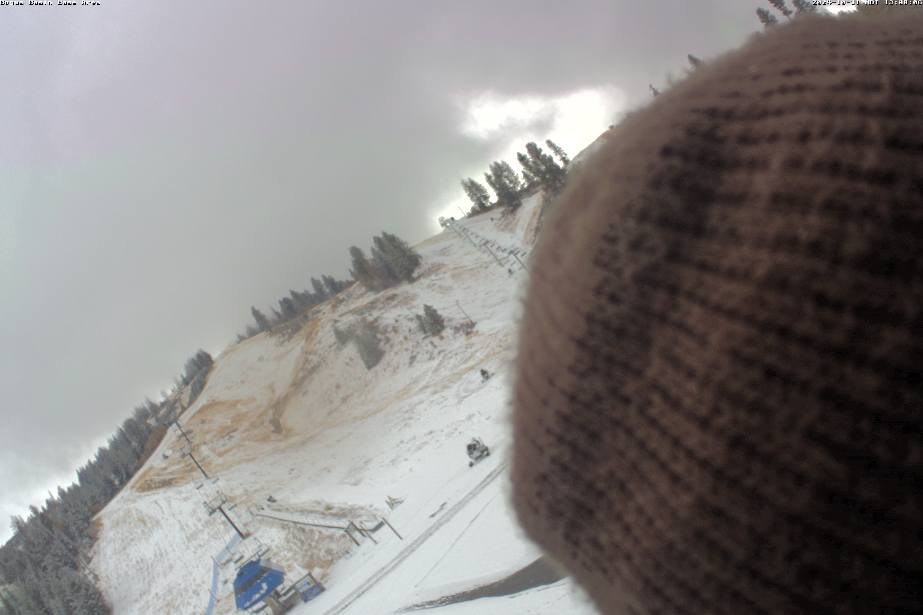
Base Area
Snow Stake
MONDAY
Apr 29
37° / 25°

22 - 33
mph
 1
1
TUESDAY
Apr 30

32° / 22°

6 - 14
mph
1
WEDNESDAY
May 1
38° / 19°

13 - 22
mph
0
THURSDAY
May 2
47° / 21°

11 - 20
mph
1
FRIDAY
May 3
48° / 30°
7 - 15
mph
0
SATURDAY
May 4

58° / 34°
4 - 12
mph
0
SUNDAY
May 5
63° / 40°
7 - 15
mph
0
advertisement

Cloudy early with isolated showers (snow level near 7,000 feet). Progressively colder (at 10,000 feet; 21f to start, dropping to 10f by evening) with gusty winds. Partly cloudy mid to later morning, becoming mostly cloudy in the afternoon and evening with scattered light snow showers expected (snow level 6,000 feet and dropping).
Periods of light snow mainly PM. Snowfall is forecast to be a trace to 1 inch
Potential Precip:
0.02 to 0.08, 80% chance
Hi: 37°Low: 25°
3,463 feet to 6882 feet
Winds W at 24 to 35 mph in the morning, becoming NW at 14 to 25 mph in the afternoon, and then variable at 10 to 19 mph with gusts to 32 overnight.
Mostly cloudy becoming clear at times and then mostly clear overnight. Periods of snow are expected in the morning.
Periods of moderate snow during the day. Snowfall is forecast to be 1 to 2 during the day.
Potential Precip:
0.03 to 0.15
Hi: 28°Low: 18°
3,463 feet to 6882 feet
Winds W at 31 to 42 mph in the morning, becoming NW at 26 to 37 mph in the afternoon, and then W at 15 to 26 mph with gusts to 32 overnight.
Partly to mostly cloudy and colder with periods of light snow expected at times, mostly in the evening and overnight. Cold northwest winds are expected.
Periods of light snow mainly later day-overnight. Snowfall is forecast to be a trace to 1 inch
Potential Precip:
0.04 to 12, 60% chance
Hi: 32°Low: 22°
3,343 feet to 6429 feet
Winds W at 14 to 25 mph in the morning, becoming variable at 5 to 12 mph in the afternoon, and then W at 8 to 16 mph overnight.
Mostly cloudy becoming cloudy at times and then mostly cloudy overnight. Periods of snow are expected in the morning through overnight.
Light snow through the day and into overnight, with periods of moderate through the evening and periods of light overnight. Snowfall is forecast to be a trace amount during the day, and 1 to 2 inches in the evening and overnight.
Potential Precip:
0.03 to 0.15
Hi: 26°Low: 19°
3,343 feet to 6429 feet
Winds W at 18 to 29 mph in the morning, becoming NW at 10 to 18 mph in the afternoon, and then NW at 13 to 22 mph overnight.
Partly to mostly cloudy and chilly, windy, with mostly isolated light snow showers.
Snow likely, a trace
Potential Precip:
0.03 to 0.25, Isolated snow showers
Hi: 38°Low: 19°
6,149 feet to 7285 feet
Winds NW at 14 to 25 mph in the morning, becoming S at 10 to 18 mph in the afternoon, and then variable at 4 to 12 mph overnight.
Partly cloudy becoming clear at times and then mostly clear overnight. Periods of snow are expected in the morning.
Periods of light snow during the day. Snowfall is forecast to be a trace amount during the day.
Potential Precip:
0.01 to 0.07
Hi: 30°Low: 26°
6,149 feet to 7285 feet
Winds NW at 15 to 26 mph in the morning, becoming NW at 14 to 23 mph in the afternoon, and then NW at 7 to 15 mph overnight.
Mostly clear through the day, becoming milder after a cold start. Skies become cloudy in the evening, overnight, with scattered snow showers then.
Periods of snow in the evening and overnight. Snowfall is forecast to be a 1 to 2 inches
Potential Precip:
0.11 to 0.24, 60% chance
Hi: 47°Low: 21°
6,358 feet to 8796 feet
Winds SW at 8 to 16 mph in the morning, becoming SE at 8 to 16 mph in the afternoon, and then variable at 5 to 13 mph overnight.
Mostly cloudy becoming partly cloudy at times continuing through overnight, with periods of snow expected in the evening.
Periods of light snow throughout the day. Snowfall is forecast to be 1 to 2 inches.
Potential Precip:
0.05 to 0.26
Hi: 37°Low: 26°
6,358 feet to 8796 feet
Winds SW at 10 to 18 mph in the morning, becoming S at 14 to 23 mph in the afternoon, and then variable at 9 to 17 mph overnight.
Cloudy with lingering snow in the morning (low pressure exits), becoming partly cloudy and milder.
Periods of snow (am), a trace
Potential Precip:
0.01 to 0.07, 40% chance
Hi: 48°Low: 30°
7,787 feet to 9440 feet
Winds NW at 6 to 14 mph through the day, becoming variable at 4 to 12 mph overnight.
Mostly clear becoming clear in the late morning and then mostly clear overnight.
Periods of snow throughout the day and overnight.
Potential Precip:
0.01 to 0.07
Hi: 39°Low: 33°
7,787 feet to 9440 feet
Winds variable at 8 to 16 mph through the day, becoming SE at 6 to 14 mph overnight.
Partly cloudy and warmer, with not much wind.
No snow.
No precipitation expected.
Hi: 58°Low: 34°
10,148 feet to 11773 feet
Winds variable at 4 to 12 mph through the day, becoming variable at 5 to 12 mph overnight.
Partly cloudy becoming mostly cloudy at times continuing through overnight, with windy conditions at times.
No snow.
No precipitation expected.
Hi: 50°Low: 45°
10,148 feet to 11773 feet
Winds variable at 4 to 12 mph through the day, becoming variable at 3 to 11 mph overnight.
Mostly cloudy becoming partly cloudy at times continuing through overnight. Expect windy conditions at times.
No snow.
No precipitation expected.
Hi: 65°Low: 58°
11,416 feet to 12658 feet
Winds variable at 6 to 14 mph through the day, becoming SE at 14 to 25 mph with gusts to 39 overnight.
Mostly cloudy becoming partly cloudy at times continuing through overnight. Expect windy conditions at times.
No snow.
No precipitation expected.
Hi: 57°Low: 53°
11,416 feet to 12658 feet
Winds variable at 9 to 17 mph through the day, becoming SE at 25 to 36 mph overnight.
 Sunrise & Sunset

Lunar Calendar


advertisement
 Bogus Basin Discussion
  Snow Maps and Weather Stations in the Area
 ![]() 12 - 15in, past 6 days. Snow surface is packed powder and machine groomed
12 - 15in, past 6 days. Snow surface is packed powder and machine groomed
Snow report provided by SnoCountry
Plan your future trip using our temperature, snowfall, snow depth, and precipitation tool
 Day |
 High Temperatures |
 Low Temperatures |
 Precipitation |
 Snowfall |
 Snow Depth |
||||||||||||||
|---|---|---|---|---|---|---|---|---|---|---|---|---|---|---|---|---|---|---|---|
| Avg | High | Year | Low | Year | Avg | High | Year | Low | Year | Avg | Max | Year | Avg | Max | Year | Avg | Max | Year | |
| 1 | 39 | 54 | 1968 | 29 | 1958 | 23 | 36 | 1962 | 10 | 1963 | 0.031 | 0.22 | 1957 | 0.17 | 2.0 | 1960 | 48.4 | 73 | 1970 |
| 2 | 39 | 50 | 1962 | 29 | 1963 | 24 | 38 | 1961 | 13 | 1964 | 0.104 | 0.88 | 1968 | 0.92 | 5.0 | 1955 | 48.2 | 74 | 1957 |
| 3 | 40 | 54 | 1960 | 25 | 1955 | 26 | 41 | 1961 | 11 | 1955 | 0.073 | 0.50 | 1965 | 0.54 | 5.0 | 1958 | 49.1 | 73 | 1970 |
| 4 | 42 | 59 | 1960 | 26 | 1958 | 27 | 46 | 1960 | 14 | 1955 | 0.055 | 0.50 | 1958 | 0.62 | 5.0 | 1958 | 48.8 | 74 | 1958 |
| 5 | 43 | 58 | 1960 | 33 | 1958 | 28 | 50 | 1960 | 15 | 1956 | 0.041 | 0.25 | 1957 | 0.04 | 0.5 | 1962 | 48.0 | 74 | 1958 |
| 6 | 40 | 59 | 1960 | 26 | 1968 | 23 | 45 | 1960 | 11 | 1958 | 0.108 | 0.90 | 1957 | 0.85 | 4.0 | 1969 | 47.8 | 76 | 1957 |
| 7 | 38 | 55 | 1960 | 26 | 1968 | 26 | 41 | 1960 | 15 | 1968 | 0.041 | 0.30 | 1958 | 0.25 | 2.0 | 1958 | 46.8 | 74 | 1958 |
| 8 | 38 | 52 | 1960 | 28 | 1963 | 25 | 40 | 1960 | 19 | 1968 | 0.045 | 0.40 | 1958 | 0.50 | 3.0 | 1958 | 44.3 | 74 | 1958 |
| 9 | 40 | 51 | 1960 | 26 | 1963 | 28 | 40 | 1960 | 18 | 1959 | 0.033 | 0.37 | 1965 | 0.38 | 5.0 | 1965 | 45.1 | 73 | 1958 |
| 10 | 40 | 49 | 1956 | 29 | 1963 | 25 | 41 | 1956 | 18 | 1970 | 0.095 | 0.55 | 1964 | 0.23 | 2.0 | 1955 | 43.0 | 73 | 1958 |
| 11 | 38 | 49 | 1959 | 23 | 1970 | 25 | 36 | 1959 | 12 | 1970 | 0.087 | 0.50 | 1964 | 0.23 | 1.0 | 1960 | 43.8 | 72 | 1958 |
| 12 | 41 | 54 | 1962 | 28 | 1964 | 25 | 40 | 1959 | 13 | 1970 | 0.031 | 0.20 | 1961 | 0.42 | 2.0 | 1960 | 42.2 | 70 | 1957 |
| 13 | 43 | 56 | 1963 | 30 | 1961 | 26 | 42 | 1962 | 8 | 1970 | 0.011 | 0.07 | 1957 | 0.19 | 1.0 | 1957 | 42.8 | 69 | 1957 |
| 14 | 44 | 59 | 1962 | 30 | 1970 | 25 | 47 | 1962 | 14 | 1967 | 0.048 | 0.42 | 1970 | 0.42 | 3.0 | 1970 | 41.2 | 69 | 1957 |
| 15 | 41 | 57 | 1962 | 25 | 1960 | 24 | 39 | 1962 | 8 | 1970 | 0.019 | 0.11 | 1955 | 0.54 | 5.0 | 1970 | 41.0 | 70 | 1970 |
| 16 | 40 | 53 | 1962 | 28 | 1963 | 23 | 34 | 1961 | 13 | 1964 | 0.049 | 0.40 | 1965 | 0.65 | 5.0 | 1965 | 41.0 | 74 | 1970 |
| 17 | 40 | 59 | 1962 | 24 | 1963 | 26 | 46 | 1962 | 13 | 1968 | 0.064 | 0.40 | 1958 | 0.42 | 4.0 | 1957 | 40.1 | 72 | 1970 |
| 18 | 39 | 59 | 1962 | 21 | 1963 | 25 | 50 | 1962 | 15 | 1967 | 0.129 | 0.83 | 1955 | 0.85 | 5.5 | 1955 | 38.2 | 70 | 1970 |
| 19 | 39 | 61 | 1962 | 24 | 1963 | 26 | 53 | 1962 | 14 | 1961 | 0.163 | 1.10 | 1963 | 1.46 | 11.0 | 1963 | 39.1 | 72 | 1970 |
| 20 | 39 | 57 | 1956 | 23 | 1970 | 25 | 46 | 1956 | 14 | 1970 | 0.163 | 1.48 | 1962 | 1.23 | 6.0 | 1962 | 39.6 | 76 | 1970 |
| 21 | 41 | 59 | 1956 | 28 | 1963 | 25 | 46 | 1956 | 12 | 1963 | 0.066 | 0.32 | 1965 | 0.46 | 4.0 | 1957 | 36.2 | 76 | 1970 |
| 22 | 40 | 60 | 1969 | 29 | 1963 | 27 | 49 | 1969 | 17 | 1964 | 0.218 | 1.35 | 1958 | 1.25 | 14.0 | 1958 | 38.5 | 76 | 1970 |
| 23 | 39 | 59 | 1969 | 25 | 1964 | 27 | 44 | 1962 | 14 | 1964 | 0.053 | 0.38 | 1958 | 0.31 | 3.0 | 1958 | 39.6 | 76 | 1970 |
| 24 | 39 | 57 | 1962 | 30 | 1964 | 27 | 47 | 1962 | 18 | 1957 | 0.034 | 0.32 | 1964 | 0.23 | 2.0 | 1958 | 38.4 | 76 | 1970 |
| 25 | 40 | 54 | 1962 | 29 | 1968 | 26 | 35 | 1959 | 18 | 1957 | 0.049 | 0.28 | 1964 | 0.15 | 1.0 | 1958 | 34.5 | 76 | 1970 |
| 26 | 37 | 50 | 1965 | 27 | 1970 | 25 | 35 | 1963 | 16 | 1970 | 0.130 | 0.95 | 1956 | 0.71 | 4.0 | 1956 | 34.0 | 75 | 1970 |
| 27 | 40 | 60 | 1968 | 23 | 1955 | 25 | 34 | 1968 | 10 | 1955 | 0.152 | 1.10 | 1963 | 0.38 | 2.0 | 1970 | 35.7 | 76 | 1955 |
| 28 | 44 | 64 | 1968 | 27 | 1967 | 29 | 40 | 1968 | 11 | 1967 | 0.108 | 0.51 | 1970 | 0.92 | 6.0 | 1962 | 32.3 | 75 | 1955 |
| 29 | 45 | 60 | 1968 | 24 | 1967 | 28 | 45 | 1961 | 10 | 1967 | 0.006 | 0.05 | 1962 | 0.04 | 0.5 | 1962 | 26.9 | 72 | 1955 |
| 30 | 48 | 62 | 1968 | 37 | 1970 | 33 | 43 | 1968 | 19 | 1969 | 0.017 | 0.15 | 1964 | 0.00 | 0.0 | 1970 | 24.8 | 68 | 1955 |
Day |
High Temperatures |
Low Temperatures |
Precipitation |
Snowfall |
Snow Depth |
||||||||||||||
|---|---|---|---|---|---|---|---|---|---|---|---|---|---|---|---|---|---|---|---|
| Avg | High | Year | Low | Year | Avg | High | Year | Low | Year | Avg | Max | Year | Avg | Max | Year | Avg | Max | Year | |
| 1 | 39 | 54 | 1968 | 29 | 1958 | 23 | 36 | 1962 | 10 | 1963 | 0.031 | 0.22 | 1957 | 0.17 | 2.0 | 1960 | 48.4 | 73 | 1970 |
| 2 | 39 | 50 | 1962 | 29 | 1963 | 24 | 38 | 1961 | 13 | 1964 | 0.104 | 0.88 | 1968 | 0.92 | 5.0 | 1955 | 48.2 | 74 | 1957 |
| 3 | 40 | 54 | 1960 | 25 | 1955 | 26 | 41 | 1961 | 11 | 1955 | 0.073 | 0.50 | 1965 | 0.54 | 5.0 | 1958 | 49.1 | 73 | 1970 |
| 4 | 42 | 59 | 1960 | 26 | 1958 | 27 | 46 | 1960 | 14 | 1955 | 0.055 | 0.50 | 1958 | 0.62 | 5.0 | 1958 | 48.8 | 74 | 1958 |
| 5 | 43 | 58 | 1960 | 33 | 1958 | 28 | 50 | 1960 | 15 | 1956 | 0.041 | 0.25 | 1957 | 0.04 | 0.5 | 1962 | 48.0 | 74 | 1958 |
| 6 | 40 | 59 | 1960 | 26 | 1968 | 23 | 45 | 1960 | 11 | 1958 | 0.108 | 0.90 | 1957 | 0.85 | 4.0 | 1969 | 47.8 | 76 | 1957 |
| 7 | 38 | 55 | 1960 | 26 | 1968 | 26 | 41 | 1960 | 15 | 1968 | 0.041 | 0.30 | 1958 | 0.25 | 2.0 | 1958 | 46.8 | 74 | 1958 |
| 8 | 38 | 52 | 1960 | 28 | 1963 | 25 | 40 | 1960 | 19 | 1968 | 0.045 | 0.40 | 1958 | 0.50 | 3.0 | 1958 | 44.3 | 74 | 1958 |
| 9 | 40 | 51 | 1960 | 26 | 1963 | 28 | 40 | 1960 | 18 | 1959 | 0.033 | 0.37 | 1965 | 0.38 | 5.0 | 1965 | 45.1 | 73 | 1958 |
| 10 | 40 | 49 | 1956 | 29 | 1963 | 25 | 41 | 1956 | 18 | 1970 | 0.095 | 0.55 | 1964 | 0.23 | 2.0 | 1955 | 43.0 | 73 | 1958 |
| 11 | 38 | 49 | 1959 | 23 | 1970 | 25 | 36 | 1959 | 12 | 1970 | 0.087 | 0.50 | 1964 | 0.23 | 1.0 | 1960 | 43.8 | 72 | 1958 |
| 12 | 41 | 54 | 1962 | 28 | 1964 | 25 | 40 | 1959 | 13 | 1970 | 0.031 | 0.20 | 1961 | 0.42 | 2.0 | 1960 | 42.2 | 70 | 1957 |
| 13 | 43 | 56 | 1963 | 30 | 1961 | 26 | 42 | 1962 | 8 | 1970 | 0.011 | 0.07 | 1957 | 0.19 | 1.0 | 1957 | 42.8 | 69 | 1957 |
| 14 | 44 | 59 | 1962 | 30 | 1970 | 25 | 47 | 1962 | 14 | 1967 | 0.048 | 0.42 | 1970 | 0.42 | 3.0 | 1970 | 41.2 | 69 | 1957 |
| 15 | 41 | 57 | 1962 | 25 | 1960 | 24 | 39 | 1962 | 8 | 1970 | 0.019 | 0.11 | 1955 | 0.54 | 5.0 | 1970 | 41.0 | 70 | 1970 |
| 16 | 40 | 53 | 1962 | 28 | 1963 | 23 | 34 | 1961 | 13 | 1964 | 0.049 | 0.40 | 1965 | 0.65 | 5.0 | 1965 | 41.0 | 74 | 1970 |
| 17 | 40 | 59 | 1962 | 24 | 1963 | 26 | 46 | 1962 | 13 | 1968 | 0.064 | 0.40 | 1958 | 0.42 | 4.0 | 1957 | 40.1 | 72 | 1970 |
| 18 | 39 | 59 | 1962 | 21 | 1963 | 25 | 50 | 1962 | 15 | 1967 | 0.129 | 0.83 | 1955 | 0.85 | 5.5 | 1955 | 38.2 | 70 | 1970 |
| 19 | 39 | 61 | 1962 | 24 | 1963 | 26 | 53 | 1962 | 14 | 1961 | 0.163 | 1.10 | 1963 | 1.46 | 11.0 | 1963 | 39.1 | 72 | 1970 |
| 20 | 39 | 57 | 1956 | 23 | 1970 | 25 | 46 | 1956 | 14 | 1970 | 0.163 | 1.48 | 1962 | 1.23 | 6.0 | 1962 | 39.6 | 76 | 1970 |
| 21 | 41 | 59 | 1956 | 28 | 1963 | 25 | 46 | 1956 | 12 | 1963 | 0.066 | 0.32 | 1965 | 0.46 | 4.0 | 1957 | 36.2 | 76 | 1970 |
| 22 | 40 | 60 | 1969 | 29 | 1963 | 27 | 49 | 1969 | 17 | 1964 | 0.218 | 1.35 | 1958 | 1.25 | 14.0 | 1958 | 38.5 | 76 | 1970 |
| 23 | 39 | 59 | 1969 | 25 | 1964 | 27 | 44 | 1962 | 14 | 1964 | 0.053 | 0.38 | 1958 | 0.31 | 3.0 | 1958 | 39.6 | 76 | 1970 |
| 24 | 39 | 57 | 1962 | 30 | 1964 | 27 | 47 | 1962 | 18 | 1957 | 0.034 | 0.32 | 1964 | 0.23 | 2.0 | 1958 | 38.4 | 76 | 1970 |
| 25 | 40 | 54 | 1962 | 29 | 1968 | 26 | 35 | 1959 | 18 | 1957 | 0.049 | 0.28 | 1964 | 0.15 | 1.0 | 1958 | 34.5 | 76 | 1970 |
| 26 | 37 | 50 | 1965 | 27 | 1970 | 25 | 35 | 1963 | 16 | 1970 | 0.130 | 0.95 | 1956 | 0.71 | 4.0 | 1956 | 34.0 | 75 | 1970 |
| 27 | 40 | 60 | 1968 | 23 | 1955 | 25 | 34 | 1968 | 10 | 1955 | 0.152 | 1.10 | 1963 | 0.38 | 2.0 | 1970 | 35.7 | 76 | 1955 |
| 28 | 44 | 64 | 1968 | 27 | 1967 | 29 | 40 | 1968 | 11 | 1967 | 0.108 | 0.51 | 1970 | 0.92 | 6.0 | 1962 | 32.3 | 75 | 1955 |
| 29 | 45 | 60 | 1968 | 24 | 1967 | 28 | 45 | 1961 | 10 | 1967 | 0.006 | 0.05 | 1962 | 0.04 | 0.5 | 1962 | 26.9 | 72 | 1955 |
| 30 | 48 | 62 | 1968 | 37 | 1970 | 33 | 43 | 1968 | 19 | 1969 | 0.017 | 0.15 | 1964 | 0.00 | 0.0 | 1970 | 24.8 | 68 | 1955 |
 Mountain Base


