 Stevens Pass... Summit @ Sno... Summit @ Sno... Summit @ Sno...
 Bogus Basin
  BOGUS BASIN Updated Oct 02 @ 11:00


 WebCams

Coaster
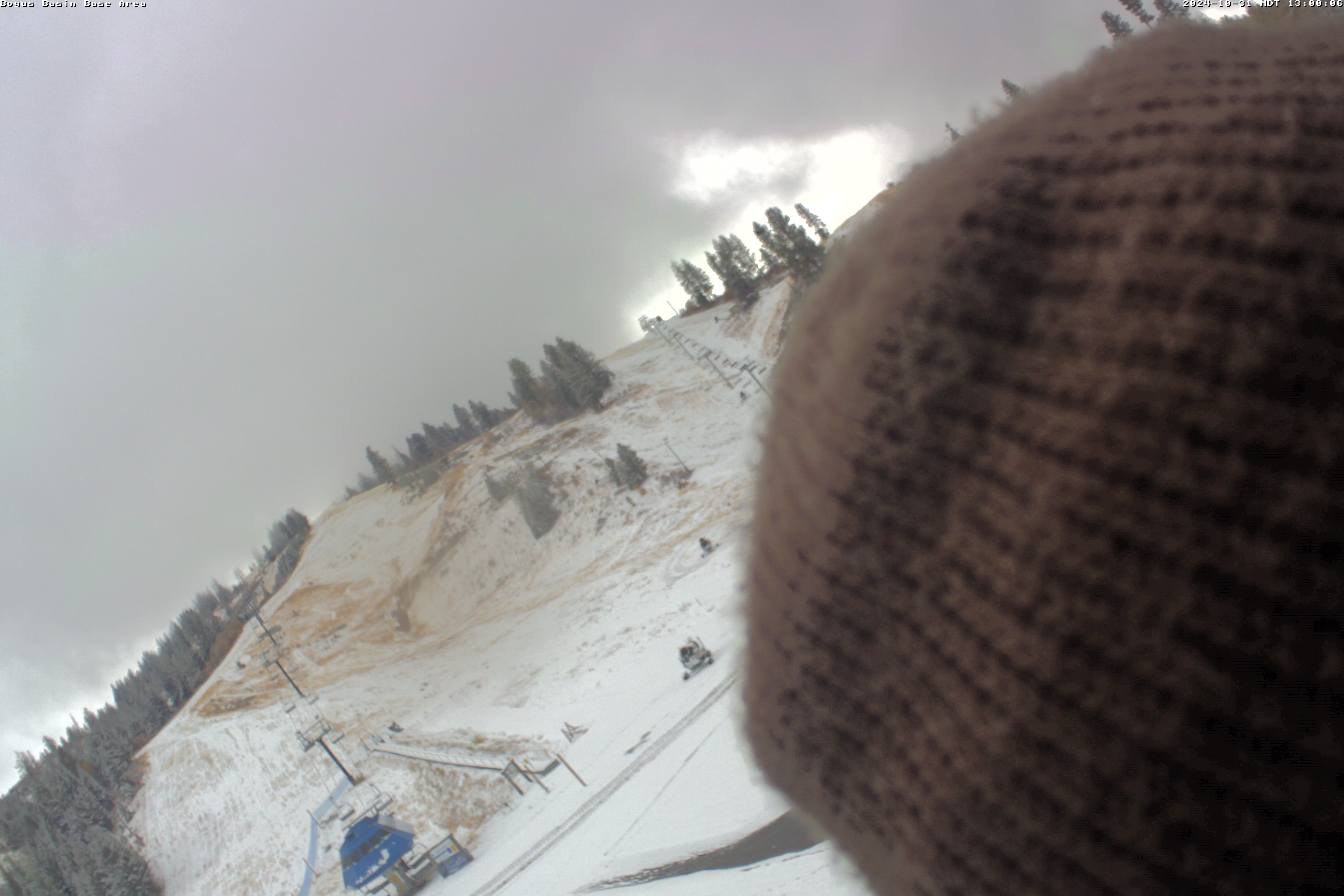
Base Area
Snow Stake
SATURDAY
Apr 20

55° / 30°

5 - 13
mph
 0
0
SUNDAY
Apr 21
44° / 31°

9 - 17
mph
0
MONDAY
Apr 22
48° / 28°
4 - 11
mph
0
TUESDAY
Apr 23

60° / 35°
6 - 14
mph
0
WEDNESDAY
Apr 24
57° / 36°
11 - 20
mph
0
THURSDAY
Apr 25

42° / 33°
10 - 18
mph
1
FRIDAY
Apr 26
34° / 30°
6 - 14
mph
1
Partly cloudy and warmer, with approaching low pressure. Marginal to no snowmaking potential is expected.
None
None
Hi: 55°Low: 30°
7,966 feet to 10335 feet
Winds SW at 6 to 14 mph in the morning, becoming variable at 4 to 12 mph in the afternoon, and then S at 8 to 16 mph overnight.
Mostly clear through the day and overnight, with windy conditions at times.
No snow.
No precipitation expected.
Hi: 44°Low: 34°
7,966 feet to 10335 feet
Winds SW at 6 to 14 mph in the morning, becoming S at 7 to 15 mph in the afternoon, and then SW at 13 to 24 mph overnight.
Partly cloudy and chilly with windy conditions (cold front). Marginal to no snowmaking potential is expected.
No snow.
No precipitation expected.
Hi: 44°Low: 31°
5,905 feet to 8057 feet
Winds W at 12 to 21 mph in the morning, becoming variable at 5 to 13 mph in the afternoon, and then variable at 3 to 11 mph overnight.
Mostly clear becoming clear in the evening continuing through overnight, with windy conditions at times.
No snow.
No precipitation expected.
Hi: 34°Low: 31°
5,905 feet to 8057 feet
Winds W at 12 to 21 mph in the morning, becoming NW at 13 to 24 mph in the afternoon, and then NW at 10 to 18 mph with gusts to 27 overnight.
Mostly clear and cool with not too much wind. Marginal to no snowmaking potential is expected.
No snow.
No precipitation expected.
Hi: 48°Low: 28°
9,044 feet to 10567 feet
Winds variable at 4 to 12 mph in the morning, becoming variable at 4 to 11 mph in the afternoon, and then variable at 4 to 12 mph overnight.
Partly cloudy through the day and overnight, with windy conditions at times.
No snow.
No precipitation expected.
Hi: 42°Low: 38°
9,044 feet to 10567 feet
Winds calm in the morning, becoming variable at 5 to 12 mph in the afternoon, and then SE at 6 to 14 mph overnight.
Partly cloudy through the morning, becoming partly to mostly cloudy with some thunderstorms and showers in the afternoon and evening. Wind gusts to 45mph are possible in any thunderstorm (afternoon, evening).
No snow.
Scattered T-storm associated showers in the afternoon, evening, .05 to .25", 40% chance (pm)
Hi: 60°Low: 35°
9,637 feet to 10848 feet
Winds SW at 6 to 14 mph in the morning, becoming variable at 4 to 12 mph in the afternoon, and then variable at 5 to 13 mph overnight.
Partly cloudy through the day and overnight, with periods of rain expected overnight.
No snow.
Potential Precip:
0.01 to 0.03
Hi: 48°Low: 40°
9,637 feet to 10848 feet
Winds S at 6 to 14 mph in the morning, becoming S at 7 to 15 mph in the afternoon, and then SW at 9 to 18 mph overnight.
Partly cloudy through the morning, becoming mostly cloudy with some thunderstorms and showers in the afternoon and evening again (increased). Wind gusts to 50mph are possible in any thunderstorm (afternoon, evening).
None
Scattered T-storm associated showers in the afternoon, evening, .15 to .55", 50% chance (pm)
Hi: 57°Low: 36°
7,305 feet to 10040 feet
Winds W at 10 to 19 mph through the day, becoming W at 9 to 17 mph with gusts to 23 overnight.
Partly cloudy through the day and overnight, with periods of rain and snow expected overnight.
Periods of light snow throughout the day and overnight. Snowfall is forecast to be a trace amount.
Potential Precip:
0.04 to 0.22
Hi: 45°Low: 31°
7,305 feet to 10040 feet
Winds W at 11 to 20 mph through the day, becoming W at 12 to 23 mph overnight.
Mostly cloudy and much cooler with showers at any time. Snow levels are running from 6,500 to 7,500 feet.
1 to 2 inches of snow above 7,000 feet
.01 to .20", 50% chance
Hi: 42°Low: 33°
6,518 feet to 8301 feet
Winds variable at 8 to 16 mph through the day, becoming variable at 5 to 13 mph overnight.
Mostly cloudy becoming cloudy in the evening continuing through overnight, with periods of snow expected at any time.
Periods of light snow throughout the day, heavy at times overnight. Snowfall is forecast to be 5 to 8 inches.
Potential Precip:
0.26 to 1.32
Hi: 36°Low: 29°
6,518 feet to 8301 feet
Winds SW at 10 to 19 mph through the day, becoming variable at 9 to 17 mph overnight.
Mostly cloudy through the day and overnight, with periods of snow expected at any time.
Periods of light snow throughout the day and overnight. Snowfall is forecast to be a trace amount.
Potential Precip:
0.03 to 0.17
Hi: 38°Low: 32°
5,798 feet to 7078 feet
Winds variable at 5 to 13 mph through the day, becoming variable at 6 to 14 mph overnight.
Mostly cloudy through the day and overnight, with periods of snow expected at any time.
Periods of light snow throughout the day and overnight. Snowfall is forecast to be 1 to 2 inches.
Potential Precip:
0.03 to 0.17
Hi: 30°Low: 28°
5,798 feet to 7078 feet
Winds variable at 6 to 14 mph through the day, becoming variable at 11 to 20 mph overnight.
 Sunrise & Sunset

Lunar Calendar


advertisement

 Bogus Basin Discussion
  Snow Maps and Weather Stations in the Area
 ![]() 12 - 15in, past 6 days. Snow surface is packed powder and machine groomed
12 - 15in, past 6 days. Snow surface is packed powder and machine groomed
Snow report provided by SnoCountry
Plan your future trip using our temperature, snowfall, snow depth, and precipitation tool
 Day |
 High Temperatures |
 Low Temperatures |
 Precipitation |
 Snowfall |
 Snow Depth |
||||||||||||||
|---|---|---|---|---|---|---|---|---|---|---|---|---|---|---|---|---|---|---|---|
| Avg | High | Year | Low | Year | Avg | High | Year | Low | Year | Avg | Max | Year | Avg | Max | Year | Avg | Max | Year | |
| 1 | 39 | 54 | 1968 | 29 | 1958 | 23 | 36 | 1962 | 10 | 1963 | 0.031 | 0.22 | 1957 | 0.17 | 2.0 | 1960 | 48.4 | 73 | 1970 |
| 2 | 39 | 50 | 1962 | 29 | 1963 | 24 | 38 | 1961 | 13 | 1964 | 0.104 | 0.88 | 1968 | 0.92 | 5.0 | 1955 | 48.2 | 74 | 1957 |
| 3 | 40 | 54 | 1960 | 25 | 1955 | 26 | 41 | 1961 | 11 | 1955 | 0.073 | 0.50 | 1965 | 0.54 | 5.0 | 1958 | 49.1 | 73 | 1970 |
| 4 | 42 | 59 | 1960 | 26 | 1958 | 27 | 46 | 1960 | 14 | 1955 | 0.055 | 0.50 | 1958 | 0.62 | 5.0 | 1958 | 48.8 | 74 | 1958 |
| 5 | 43 | 58 | 1960 | 33 | 1958 | 28 | 50 | 1960 | 15 | 1956 | 0.041 | 0.25 | 1957 | 0.04 | 0.5 | 1962 | 48.0 | 74 | 1958 |
| 6 | 40 | 59 | 1960 | 26 | 1968 | 23 | 45 | 1960 | 11 | 1958 | 0.108 | 0.90 | 1957 | 0.85 | 4.0 | 1969 | 47.8 | 76 | 1957 |
| 7 | 38 | 55 | 1960 | 26 | 1968 | 26 | 41 | 1960 | 15 | 1968 | 0.041 | 0.30 | 1958 | 0.25 | 2.0 | 1958 | 46.8 | 74 | 1958 |
| 8 | 38 | 52 | 1960 | 28 | 1963 | 25 | 40 | 1960 | 19 | 1968 | 0.045 | 0.40 | 1958 | 0.50 | 3.0 | 1958 | 44.3 | 74 | 1958 |
| 9 | 40 | 51 | 1960 | 26 | 1963 | 28 | 40 | 1960 | 18 | 1959 | 0.033 | 0.37 | 1965 | 0.38 | 5.0 | 1965 | 45.1 | 73 | 1958 |
| 10 | 40 | 49 | 1956 | 29 | 1963 | 25 | 41 | 1956 | 18 | 1970 | 0.095 | 0.55 | 1964 | 0.23 | 2.0 | 1955 | 43.0 | 73 | 1958 |
| 11 | 38 | 49 | 1959 | 23 | 1970 | 25 | 36 | 1959 | 12 | 1970 | 0.087 | 0.50 | 1964 | 0.23 | 1.0 | 1960 | 43.8 | 72 | 1958 |
| 12 | 41 | 54 | 1962 | 28 | 1964 | 25 | 40 | 1959 | 13 | 1970 | 0.031 | 0.20 | 1961 | 0.42 | 2.0 | 1960 | 42.2 | 70 | 1957 |
| 13 | 43 | 56 | 1963 | 30 | 1961 | 26 | 42 | 1962 | 8 | 1970 | 0.011 | 0.07 | 1957 | 0.19 | 1.0 | 1957 | 42.8 | 69 | 1957 |
| 14 | 44 | 59 | 1962 | 30 | 1970 | 25 | 47 | 1962 | 14 | 1967 | 0.048 | 0.42 | 1970 | 0.42 | 3.0 | 1970 | 41.2 | 69 | 1957 |
| 15 | 41 | 57 | 1962 | 25 | 1960 | 24 | 39 | 1962 | 8 | 1970 | 0.019 | 0.11 | 1955 | 0.54 | 5.0 | 1970 | 41.0 | 70 | 1970 |
| 16 | 40 | 53 | 1962 | 28 | 1963 | 23 | 34 | 1961 | 13 | 1964 | 0.049 | 0.40 | 1965 | 0.65 | 5.0 | 1965 | 41.0 | 74 | 1970 |
| 17 | 40 | 59 | 1962 | 24 | 1963 | 26 | 46 | 1962 | 13 | 1968 | 0.064 | 0.40 | 1958 | 0.42 | 4.0 | 1957 | 40.1 | 72 | 1970 |
| 18 | 39 | 59 | 1962 | 21 | 1963 | 25 | 50 | 1962 | 15 | 1967 | 0.129 | 0.83 | 1955 | 0.85 | 5.5 | 1955 | 38.2 | 70 | 1970 |
| 19 | 39 | 61 | 1962 | 24 | 1963 | 26 | 53 | 1962 | 14 | 1961 | 0.163 | 1.10 | 1963 | 1.46 | 11.0 | 1963 | 39.1 | 72 | 1970 |
| 20 | 39 | 57 | 1956 | 23 | 1970 | 25 | 46 | 1956 | 14 | 1970 | 0.163 | 1.48 | 1962 | 1.23 | 6.0 | 1962 | 39.6 | 76 | 1970 |
| 21 | 41 | 59 | 1956 | 28 | 1963 | 25 | 46 | 1956 | 12 | 1963 | 0.066 | 0.32 | 1965 | 0.46 | 4.0 | 1957 | 36.2 | 76 | 1970 |
| 22 | 40 | 60 | 1969 | 29 | 1963 | 27 | 49 | 1969 | 17 | 1964 | 0.218 | 1.35 | 1958 | 1.25 | 14.0 | 1958 | 38.5 | 76 | 1970 |
| 23 | 39 | 59 | 1969 | 25 | 1964 | 27 | 44 | 1962 | 14 | 1964 | 0.053 | 0.38 | 1958 | 0.31 | 3.0 | 1958 | 39.6 | 76 | 1970 |
| 24 | 39 | 57 | 1962 | 30 | 1964 | 27 | 47 | 1962 | 18 | 1957 | 0.034 | 0.32 | 1964 | 0.23 | 2.0 | 1958 | 38.4 | 76 | 1970 |
| 25 | 40 | 54 | 1962 | 29 | 1968 | 26 | 35 | 1959 | 18 | 1957 | 0.049 | 0.28 | 1964 | 0.15 | 1.0 | 1958 | 34.5 | 76 | 1970 |
| 26 | 37 | 50 | 1965 | 27 | 1970 | 25 | 35 | 1963 | 16 | 1970 | 0.130 | 0.95 | 1956 | 0.71 | 4.0 | 1956 | 34.0 | 75 | 1970 |
| 27 | 40 | 60 | 1968 | 23 | 1955 | 25 | 34 | 1968 | 10 | 1955 | 0.152 | 1.10 | 1963 | 0.38 | 2.0 | 1970 | 35.7 | 76 | 1955 |
| 28 | 44 | 64 | 1968 | 27 | 1967 | 29 | 40 | 1968 | 11 | 1967 | 0.108 | 0.51 | 1970 | 0.92 | 6.0 | 1962 | 32.3 | 75 | 1955 |
| 29 | 45 | 60 | 1968 | 24 | 1967 | 28 | 45 | 1961 | 10 | 1967 | 0.006 | 0.05 | 1962 | 0.04 | 0.5 | 1962 | 26.9 | 72 | 1955 |
| 30 | 48 | 62 | 1968 | 37 | 1970 | 33 | 43 | 1968 | 19 | 1969 | 0.017 | 0.15 | 1964 | 0.00 | 0.0 | 1970 | 24.8 | 68 | 1955 |
Day |
High Temperatures |
Low Temperatures |
Precipitation |
Snowfall |
Snow Depth |
||||||||||||||
|---|---|---|---|---|---|---|---|---|---|---|---|---|---|---|---|---|---|---|---|
| Avg | High | Year | Low | Year | Avg | High | Year | Low | Year | Avg | Max | Year | Avg | Max | Year | Avg | Max | Year | |
| 1 | 39 | 54 | 1968 | 29 | 1958 | 23 | 36 | 1962 | 10 | 1963 | 0.031 | 0.22 | 1957 | 0.17 | 2.0 | 1960 | 48.4 | 73 | 1970 |
| 2 | 39 | 50 | 1962 | 29 | 1963 | 24 | 38 | 1961 | 13 | 1964 | 0.104 | 0.88 | 1968 | 0.92 | 5.0 | 1955 | 48.2 | 74 | 1957 |
| 3 | 40 | 54 | 1960 | 25 | 1955 | 26 | 41 | 1961 | 11 | 1955 | 0.073 | 0.50 | 1965 | 0.54 | 5.0 | 1958 | 49.1 | 73 | 1970 |
| 4 | 42 | 59 | 1960 | 26 | 1958 | 27 | 46 | 1960 | 14 | 1955 | 0.055 | 0.50 | 1958 | 0.62 | 5.0 | 1958 | 48.8 | 74 | 1958 |
| 5 | 43 | 58 | 1960 | 33 | 1958 | 28 | 50 | 1960 | 15 | 1956 | 0.041 | 0.25 | 1957 | 0.04 | 0.5 | 1962 | 48.0 | 74 | 1958 |
| 6 | 40 | 59 | 1960 | 26 | 1968 | 23 | 45 | 1960 | 11 | 1958 | 0.108 | 0.90 | 1957 | 0.85 | 4.0 | 1969 | 47.8 | 76 | 1957 |
| 7 | 38 | 55 | 1960 | 26 | 1968 | 26 | 41 | 1960 | 15 | 1968 | 0.041 | 0.30 | 1958 | 0.25 | 2.0 | 1958 | 46.8 | 74 | 1958 |
| 8 | 38 | 52 | 1960 | 28 | 1963 | 25 | 40 | 1960 | 19 | 1968 | 0.045 | 0.40 | 1958 | 0.50 | 3.0 | 1958 | 44.3 | 74 | 1958 |
| 9 | 40 | 51 | 1960 | 26 | 1963 | 28 | 40 | 1960 | 18 | 1959 | 0.033 | 0.37 | 1965 | 0.38 | 5.0 | 1965 | 45.1 | 73 | 1958 |
| 10 | 40 | 49 | 1956 | 29 | 1963 | 25 | 41 | 1956 | 18 | 1970 | 0.095 | 0.55 | 1964 | 0.23 | 2.0 | 1955 | 43.0 | 73 | 1958 |
| 11 | 38 | 49 | 1959 | 23 | 1970 | 25 | 36 | 1959 | 12 | 1970 | 0.087 | 0.50 | 1964 | 0.23 | 1.0 | 1960 | 43.8 | 72 | 1958 |
| 12 | 41 | 54 | 1962 | 28 | 1964 | 25 | 40 | 1959 | 13 | 1970 | 0.031 | 0.20 | 1961 | 0.42 | 2.0 | 1960 | 42.2 | 70 | 1957 |
| 13 | 43 | 56 | 1963 | 30 | 1961 | 26 | 42 | 1962 | 8 | 1970 | 0.011 | 0.07 | 1957 | 0.19 | 1.0 | 1957 | 42.8 | 69 | 1957 |
| 14 | 44 | 59 | 1962 | 30 | 1970 | 25 | 47 | 1962 | 14 | 1967 | 0.048 | 0.42 | 1970 | 0.42 | 3.0 | 1970 | 41.2 | 69 | 1957 |
| 15 | 41 | 57 | 1962 | 25 | 1960 | 24 | 39 | 1962 | 8 | 1970 | 0.019 | 0.11 | 1955 | 0.54 | 5.0 | 1970 | 41.0 | 70 | 1970 |
| 16 | 40 | 53 | 1962 | 28 | 1963 | 23 | 34 | 1961 | 13 | 1964 | 0.049 | 0.40 | 1965 | 0.65 | 5.0 | 1965 | 41.0 | 74 | 1970 |
| 17 | 40 | 59 | 1962 | 24 | 1963 | 26 | 46 | 1962 | 13 | 1968 | 0.064 | 0.40 | 1958 | 0.42 | 4.0 | 1957 | 40.1 | 72 | 1970 |
| 18 | 39 | 59 | 1962 | 21 | 1963 | 25 | 50 | 1962 | 15 | 1967 | 0.129 | 0.83 | 1955 | 0.85 | 5.5 | 1955 | 38.2 | 70 | 1970 |
| 19 | 39 | 61 | 1962 | 24 | 1963 | 26 | 53 | 1962 | 14 | 1961 | 0.163 | 1.10 | 1963 | 1.46 | 11.0 | 1963 | 39.1 | 72 | 1970 |
| 20 | 39 | 57 | 1956 | 23 | 1970 | 25 | 46 | 1956 | 14 | 1970 | 0.163 | 1.48 | 1962 | 1.23 | 6.0 | 1962 | 39.6 | 76 | 1970 |
| 21 | 41 | 59 | 1956 | 28 | 1963 | 25 | 46 | 1956 | 12 | 1963 | 0.066 | 0.32 | 1965 | 0.46 | 4.0 | 1957 | 36.2 | 76 | 1970 |
| 22 | 40 | 60 | 1969 | 29 | 1963 | 27 | 49 | 1969 | 17 | 1964 | 0.218 | 1.35 | 1958 | 1.25 | 14.0 | 1958 | 38.5 | 76 | 1970 |
| 23 | 39 | 59 | 1969 | 25 | 1964 | 27 | 44 | 1962 | 14 | 1964 | 0.053 | 0.38 | 1958 | 0.31 | 3.0 | 1958 | 39.6 | 76 | 1970 |
| 24 | 39 | 57 | 1962 | 30 | 1964 | 27 | 47 | 1962 | 18 | 1957 | 0.034 | 0.32 | 1964 | 0.23 | 2.0 | 1958 | 38.4 | 76 | 1970 |
| 25 | 40 | 54 | 1962 | 29 | 1968 | 26 | 35 | 1959 | 18 | 1957 | 0.049 | 0.28 | 1964 | 0.15 | 1.0 | 1958 | 34.5 | 76 | 1970 |
| 26 | 37 | 50 | 1965 | 27 | 1970 | 25 | 35 | 1963 | 16 | 1970 | 0.130 | 0.95 | 1956 | 0.71 | 4.0 | 1956 | 34.0 | 75 | 1970 |
| 27 | 40 | 60 | 1968 | 23 | 1955 | 25 | 34 | 1968 | 10 | 1955 | 0.152 | 1.10 | 1963 | 0.38 | 2.0 | 1970 | 35.7 | 76 | 1955 |
| 28 | 44 | 64 | 1968 | 27 | 1967 | 29 | 40 | 1968 | 11 | 1967 | 0.108 | 0.51 | 1970 | 0.92 | 6.0 | 1962 | 32.3 | 75 | 1955 |
| 29 | 45 | 60 | 1968 | 24 | 1967 | 28 | 45 | 1961 | 10 | 1967 | 0.006 | 0.05 | 1962 | 0.04 | 0.5 | 1962 | 26.9 | 72 | 1955 |
| 30 | 48 | 62 | 1968 | 37 | 1970 | 33 | 43 | 1968 | 19 | 1969 | 0.017 | 0.15 | 1964 | 0.00 | 0.0 | 1970 | 24.8 | 68 | 1955 |
advertisement
 Mountain Base


