 Mad River Mo... Nitehawk Ski... Clear Fork R... Snow Trails
 Red Mountain Resort
  WebCams
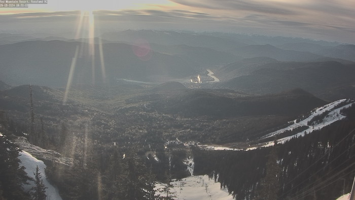
Granite Cam
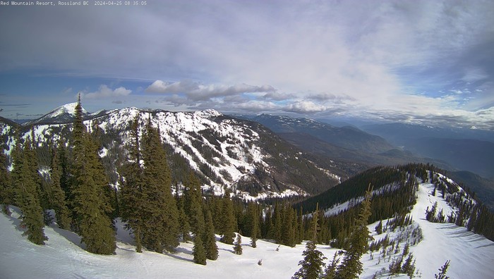
Grey Mountain Cam
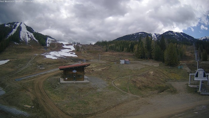
Base Cam
FRIDAY
Apr 26

39° / 37°

4 - 11
mph
 0
0
SATURDAY
Apr 27

42° / 30°

10 - 19
mph
0
SUNDAY
Apr 28

36° / 26°
10 - 18
mph
3
MONDAY
Apr 29
36° / 25°

14 - 23
mph
0
TUESDAY
Apr 30
33° / 27°
4 - 12
mph
1
WEDNESDAY
May 1
37° / 33°
5 - 13
mph
0
THURSDAY
May 2

46° / 42°
10 - 19
mph
0
advertisement

Mostly cloudy becoming partly cloudy in the late morning and then mostly cloudy overnight. Periods of rain and snow are expected overnight.
Light snow overnight. Snowfall is forecast to be a trace amount overnight.
Potential Precip:
0.09 to 0.44
Hi: 41°Low: 37°
6,596 feet to 7067 feet
Winds variable at 4 to 12 mph in the morning, becoming variable at 4 to 11 mph in the afternoon, and then variable at 5 to 13 mph overnight.
Cloudy becoming mostly cloudy at times continuing through overnight. Periods of rain and snow are expected overnight.
Light snow through the day and into overnight. Snowfall is forecast to be a trace amount during the day, and a trace amount in the evening and overnight.
Potential Precip:
0.12 to 0.6
Hi: 43°Low: 31°
4,760 feet to 7204 feet
Winds S at 11 to 20 mph in the morning, becoming S at 10 to 18 mph in the afternoon through overnight.
Cloudy through the day and overnight, with periods of snow expected at any time.
Light snow through the day into the evening, becoming moderate with periods of heavy overnight. Snowfall is forecast to be a trace amount during the day, and 2 to 4 inches in the evening and overnight.
Potential Precip:
0.14 to 0.7
Hi: 37°Low: 28°
3,911 feet to 6268 feet
Winds S at 9 to 17 mph in the morning, becoming S at 8 to 16 mph in the afternoon, and then SW at 10 to 19 mph overnight.
Cloudy becoming mostly clear in the afternoon and then mostly cloudy overnight. Periods of snow are expected in the morning.
Periods of light snow throughout the day. Snowfall is forecast to be a trace amount.
Potential Precip:
0.01 to 0.06
Hi: 38°Low: 25°
2,355 feet to 6085 feet
Winds NW at 14 to 25 mph in the morning, becoming W at 13 to 22 mph in the afternoon, and then SW at 6 to 14 mph overnight.
Cloudy becoming partly cloudy at times continuing through overnight, with periods of snow expected at any time.
Periods of light snow throughout the day and overnight. Snowfall is forecast to be 1 to 2 inches.
Potential Precip:
0.04 to 0.2
Hi: 34°Low: 28°
3,907 feet to 5452 feet
Winds variable at 3 to 11 mph through the day, becoming variable at 4 to 12 mph overnight.
Partly cloudy becoming cloudy overnight continuing through overnight, with periods of snow expected in the morning through afternoon.
Periods of light snow throughout the day. Snowfall is forecast to be a trace amount.
Potential Precip:
0 to 0.02
Hi: 38°Low: 34°
3,000 feet to 6726 feet
Winds variable at 5 to 13 mph through the day, becoming SE at 6 to 14 mph overnight.
Mostly cloudy becoming partly cloudy in the afternoon continuing through overnight. Expect windy conditions at times.
No snow.
No precipitation expected.
Hi: 47°Low: 42°
7,323 feet to 7977 feet
Winds SE at 9 to 18 mph through the day, becoming S at 7 to 15 mph overnight.
Mostly cloudy becoming partly cloudy in the afternoon continuing through overnight. Expect windy conditions at times.
No snow.
No precipitation expected.
Hi: 47°Low: 42°
7,323 feet to 7977 feet
Winds SE at 9 to 18 mph through the day, becoming S at 7 to 15 mph overnight.
 Sunrise & Sunset

Lunar Calendar


advertisement
 Snow Maps and Weather Stations in the Area
 ![]() 18in, past 72 hours. Snow surface is packed powder
18in, past 72 hours. Snow surface is packed powder
Snow report provided by SnoCountry
advertisement
 Mountain Base


