 Stevens Pass... Summit @ Sno... Summit @ Sno... Summit @ Sno...
 La Poya-Vallorcine
  WebCams
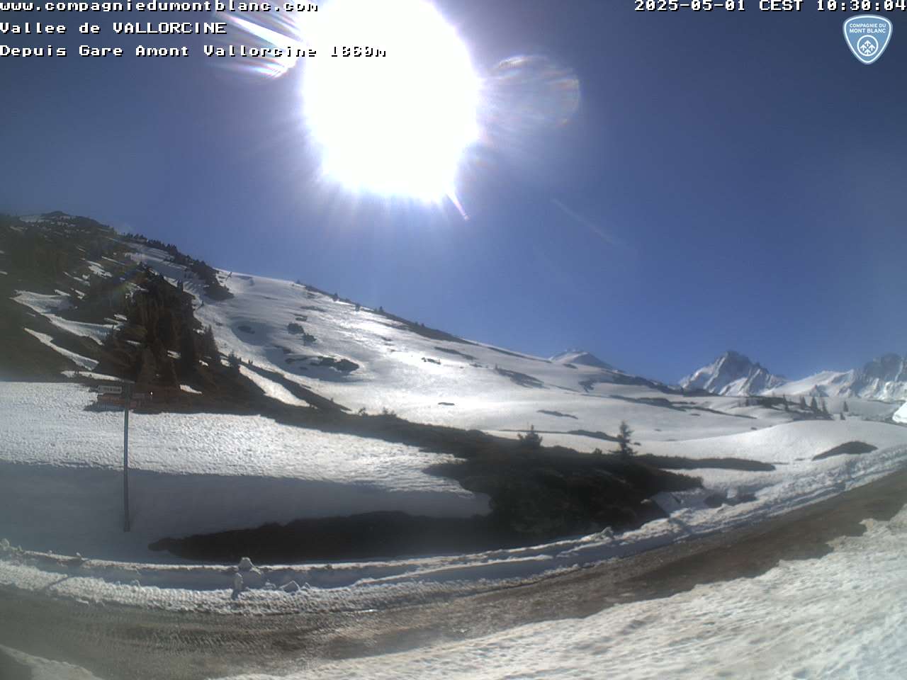
Webcam situee a la gare d'arrivee de la telecabine de Vallorcine 1850 m
TUESDAY
Apr 16

53° / 43°

8 - 16
mph
 0
0
WEDNESDAY
Apr 17
38° / 30°
6 - 14
mph
1
THURSDAY
Apr 18
32° / 25°
5 - 13
mph
14
FRIDAY
Apr 19
31° / 26°
5 - 13
mph
23
SATURDAY
Apr 20

39° / 21°
4 - 12
mph
31
SUNDAY
Apr 21
40° / 33°
4 - 12
mph
10
MONDAY
Apr 22

46° / 34°
4 - 12
mph
8
Clear becoming cloudy at times continuing through overnight, with periods of rain expected in the afternoon through overnight.
No snow.
Potential Precip:
0.2 to 1
Hi: 53°Low: 43°
7,338 feet to 9492 feet
Winds calm in the morning, becoming SW at 8 to 16 mph in the afternoon, and then W at 7 to 15 mph overnight.
Partly cloudy becoming cloudy at times continuing through overnight, with periods of snow expected at any time.
Light snow through the day and into overnight. Snowfall is forecast to be 1 to 2 during the day, and a trace amount in the evening and overnight.
Potential Precip:
0.33 to 1.65
Hi: 38°Low: 30°
3,934 feet to 6189 feet
Winds W at 6 to 14 mph in the morning, becoming NW at 6 to 14 mph in the afternoon, and then variable at 5 to 13 mph overnight.
Cloudy becoming mostly cloudy in the late morning continuing through overnight, with periods of snow expected at any time.
Heavy snow during the day, becoming moderate in the evening and light overnight. Snowfall is forecast to be 10 to 14 during the day, and 1 to 2 inches in the evening and overnight.
Potential Precip:
0.59 to 2.95
Hi: 32°Low: 25°
2,449 feet to 4412 feet
Winds variable at 5 to 13 mph throughout the day and into overnight.
Mostly cloudy becoming partly cloudy at times continuing through overnight, with periods of snow expected at any time.
Periods of heavy snow throughout the day, light at times overnight. Snowfall is forecast to be 21 to 25 inches.
Potential Precip:
0.69 to 3.44
Hi: 31°Low: 26°
2,523 feet to 4011 feet
Winds variable at 4 to 12 mph in the morning, becoming variable at 5 to 13 mph in the afternoon, and then variable at 6 to 14 mph overnight.
Mostly clear through the day becoming mostly cloudy overnight. Periods of rain and snow are expected overnight.
Periods of heavy snow throughout the day, light at times overnight. Snowfall is forecast to be 29 to 33 inches.
Potential Precip:
0.69 to 3.47
Hi: 39°Low: 21°
1,255 feet to 6259 feet
Winds variable at 4 to 12 mph throughout the day and into overnight.
Partly cloudy becoming mostly clear in the afternoon continuing through overnight, with periods of snow expected in the morning.
Periods of heavy snow throughout the day. Snowfall is forecast to be 8 to 12 inches.
Potential Precip:
0.7 to 3.52
Hi: 40°Low: 33°
4,598 feet to 6577 feet
Winds variable at 4 to 12 mph throughout the day and into overnight.
Mostly clear becoming clear in the late morning continuing through overnight.
Periods of snow throughout the day and overnight.
Potential Precip:
0.7 to 3.52
Hi: 46°Low: 34°
4,982 feet to 7644 feet
Winds variable at 4 to 12 mph throughout the day and into overnight.
 Sunrise & Sunset

Lunar Calendar


 Mid-Mountain


