 Mt Waterman Mountain Hig... Mt Baldy Alta Sierra...
 Summit @ Snoqualmie-Alpen
  Stampede Pass, WA Updated Jul 01 @ 06:16

 WebCams

Top of Alpental

Alpental Base

Summit Central
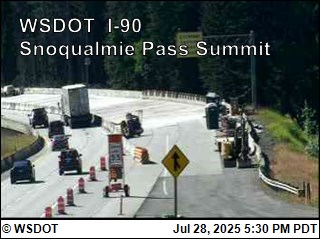
Summit Road Cam
TUESDAY
Jul 1

75° / 50°

5 - 12
mph
 0
0
WEDNESDAY
Jul 2

65° / 47°
5 - 13
mph
0
THURSDAY
Jul 3
62° / 44°
5 - 12
mph
0
FRIDAY
Jul 4

59° / 43°
4 - 12
mph
0
SATURDAY
Jul 5
62° / 48°
5 - 13
mph
0
SUNDAY
Jul 6
69° / 54°
5 - 13
mph
0
MONDAY
Jul 7
75° / 60°
5 - 13
mph
0
Clear becoming partly cloudy at times continuing through overnight. Expect windy conditions at times.
No snow.
No precipitation expected.
Hi: 75°Low: 50°
12,866 feet to 13553 feet
Winds NW at 6 to 14 mph in the morning, becoming variable at 5 to 12 mph in the afternoon through overnight.
Mostly clear becoming partly cloudy overnight continuing through overnight, with periods of rain developing in the afternoon through overnight.
No snow.
Potential Precip:
0 to 0.02
Hi: 65°Low: 47°
10,974 feet to 12149 feet
Winds W at 6 to 14 mph in the morning, becoming variable at 5 to 13 mph in the afternoon, and then variable at 4 to 12 mph overnight.
Clear becoming partly cloudy at times continuing through overnight, with windy conditions at times.
No snow.
No precipitation expected.
Hi: 62°Low: 44°
11,018 feet to 12276 feet
Winds variable at 5 to 13 mph in the morning, becoming variable at 5 to 12 mph in the afternoon through overnight.
Mostly clear becoming clear at times continuing through overnight, with windy conditions at times.
No snow.
No precipitation expected.
Hi: 59°Low: 43°
9,817 feet to 11107 feet
Winds W at 7 to 15 mph in the morning, becoming variable at 4 to 12 mph in the afternoon, and then variable at 5 to 12 mph overnight.
Mostly clear through the day and overnight, with windy conditions at times.
No snow.
No precipitation expected.
Hi: 62°Low: 48°
11,228 feet to 12795 feet
Winds variable at 5 to 13 mph through the day, becoming variable at 4 to 12 mph overnight.
Partly cloudy through the day becoming mostly clear overnight. Expect windy conditions at times.
No snow.
No precipitation expected.
Hi: 69°Low: 54°
12,792 feet to 13961 feet
Winds variable at 5 to 13 mph through the day, becoming variable at 5 to 12 mph overnight.
Clear through the day and overnight, with windy conditions at times.
No snow.
No precipitation expected.
Hi: 75°Low: 60°
13,866 feet to 14639 feet
Winds variable at 5 to 13 mph through the day, becoming variable at 5 to 12 mph overnight.
 Sunrise & Sunset

Lunar Calendar


 Snow Maps and Weather Stations in the Area
 ![]() 2 - 5in, past 72 hours. Snow surface is powder and packed powder
2 - 5in, past 72 hours. Snow surface is powder and packed powder
Snow report provided by SnoCountry
 Mid-Mountain


