 Stevens Pass... Summit @ Sno... Summit @ Sno... Summit @ Sno...
 Summit @ Snoqualmie-East
  Stampede Pass, WA Updated Apr 25 @ 08:14

 North
North WebCams

Top of Alpental

Alpental Base

Summit Central
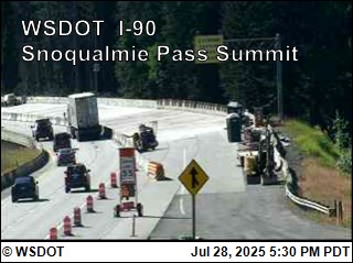
Summit Road Cam
THURSDAY
Apr 25
41° / 38°
0 - 0
mph
 0
0
FRIDAY
Apr 26

45° / 39°

4 - 11
mph
0
SATURDAY
Apr 27
38° / 35°
0 - 0
mph
2
SUNDAY
Apr 28

37° / 29°
4 - 12
mph
7
MONDAY
Apr 29
37° / 27°
4 - 12
mph
2
TUESDAY
Apr 30
48° / 36°
4 - 11
mph
0
WEDNESDAY
May 1
53° / 29°
4 - 12
mph
3
Cloudy becoming mostly cloudy at times continuing through overnight, with periods of rain and snow expected overnight.
Light snow overnight. Snowfall is forecast to be a trace amount overnight.
Potential Precip:
0.4 to 1.99
Hi: 41°Low: 38°
5,083 feet to 6156 feet
Winds calm through the day, becoming variable at 4 to 11 mph overnight.
Mostly cloudy becoming cloudy overnight continuing through overnight, with periods of rain expected at any time.
No snow.
Potential Precip:
0.07 to 0.33
Hi: 45°Low: 39°
5,179 feet to 5984 feet
Winds variable at 5 to 12 mph in the morning, becoming variable at 4 to 11 mph in the afternoon through overnight.
Cloudy becoming mostly cloudy overnight continuing through overnight, with periods of snow expected at any time.
Light snow through the day and into overnight. Snowfall is forecast to be 1 to 2 during the day, and 1 to 2 inches in the evening and overnight.
Potential Precip:
0.34 to 1.72
Hi: 38°Low: 35°
4,179 feet to 5222 feet
Winds variable at 5 to 12 mph in the morning, becoming calm in the afternoon, and then variable at 4 to 12 mph overnight.
Cloudy becoming partly cloudy at times continuing through overnight, with periods of snow expected at any time.
Periods of moderate to heavy snow throughout the day, moderate at times overnight. Snowfall is forecast to be 6 to 9 inches.
Potential Precip:
0.43 to 2.14
Hi: 37°Low: 29°
2,471 feet to 4410 feet
Winds variable at 4 to 12 mph through the day, becoming variable at 5 to 13 mph overnight.
Cloudy through the day becoming mostly cloudy overnight. Periods of snow are expected in the morning through evening.
Periods of light to moderate snow throughout the day. Snowfall is forecast to be 2 to 3 inches.
Potential Precip:
0.1 to 0.51
Hi: 37°Low: 27°
1,657 feet to 4279 feet
Winds variable at 4 to 12 mph through the day, becoming variable at 4 to 11 mph overnight.
Mostly cloudy through the day becoming cloudy overnight. Periods of rain are expected in the morning through afternoon.
No snow.
Potential Precip:
0 to 0.02
Hi: 48°Low: 36°
5,003 feet to 8091 feet
Winds variable at 4 to 11 mph through the day, becoming variable at 5 to 13 mph overnight.
Mostly cloudy becoming partly cloudy at times continuing through overnight, with periods of rain and snow expected overnight.
Periods of moderate to heavy snow throughout the day. Snowfall is forecast to be 3 to 5 inches.
Potential Precip:
0.33 to 1.66
Hi: 53°Low: 29°
2,259 feet to 7581 feet
Winds variable at 4 to 12 mph through the day, becoming variable at 4 to 11 mph overnight.
 Sunrise & Sunset

Lunar Calendar


 Snow Maps and Weather Stations in the Area
  Mid-Mountain


