 Mt Waterman
  Mountain Hig... Mt Baldy
  Alta Sierra...
 Vail
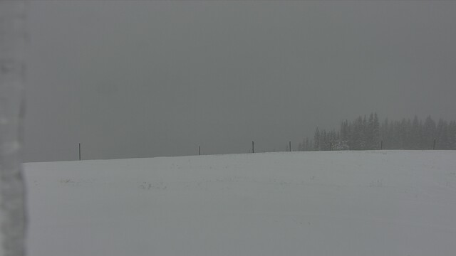
Vail  Copper Mountain - Red Cliff Pass, CO Updated Jun 01 @ 03:14
 West
West WebCams
Blue Sky - 11,570'

Vail Village - Near Base

Covered Bridge
SUNDAY
Jun 1

65° / 46°

5 - 12
mph
 0
0
MONDAY
Jun 2

52° / 38°
5 - 13
mph
0
TUESDAY
Jun 3

55° / 38°
4 - 12
mph
0
WEDNESDAY
Jun 4
53° / 35°
4 - 12
mph
0
THURSDAY
Jun 5

53° / 38°
7 - 15
mph
0
FRIDAY
Jun 6
52° / 38°
5 - 13
mph
0
SATURDAY
Jun 7
59° / 43°
7 - 15
mph
0
Cloudy becoming mostly clear at times and then mostly cloudy overnight. Periods of rain are expected at any time.
No snow.
Potential Precip:
0.01 to 0.07
Hi: 71°Low: 51°
13,489 feet to 15167 feet
Winds variable at 7 to 15 mph in the morning, becoming variable at 5 to 12 mph in the afternoon, and then variable at 4 to 12 mph overnight.
Cloudy becoming mostly clear at times and then mostly cloudy overnight. Periods of rain are expected at any time.
No snow.
Potential Precip:
0.01 to 0.07
Hi: 51°Low: 41°
13,489 feet to 15167 feet
Winds NW at 10 to 18 mph in the morning, becoming NW at 6 to 14 mph in the afternoon, and then variable at 4 to 12 mph overnight.
Cloudy becoming partly cloudy in the evening continuing through overnight, with periods of rain expected at any time.
No snow.
Potential Precip:
0.34 to 1.72
Hi: 58°Low: 43°
12,105 feet to 13347 feet
Winds variable at 5 to 12 mph in the morning, becoming variable at 5 to 13 mph in the afternoon through overnight.
Cloudy becoming partly cloudy in the evening continuing through overnight, with periods of rain and snow expected overnight.
Moderate snow with periods of heavy during the day, becoming light with periods of moderate through the evening and overnight. Snowfall is forecast to be 3 to 5 during the day, and 1 to 2 inches in the evening and overnight.
Potential Precip:
0.34 to 1.72
Hi: 39°Low: 33°
12,105 feet to 13347 feet
Winds variable at 5 to 13 mph in the morning, becoming NW at 9 to 17 mph in the afternoon, and then W at 10 to 18 mph with gusts to 24 overnight.
Partly cloudy becoming mostly cloudy in the late morning continuing through overnight. Periods of rain are expected in the afternoon through overnight.
No snow.
Potential Precip:
0.02 to 0.1
Hi: 61°Low: 43°
12,583 feet to 13615 feet
Winds NW at 11 to 20 mph in the morning, becoming variable at 4 to 12 mph in the afternoon, and then SW at 7 to 15 mph overnight.
Partly cloudy becoming mostly cloudy in the late morning continuing through overnight. Periods of snow are expected in the afternoon through overnight.
Light snow through the day and into overnight. Snowfall is forecast to be a trace amount during the day, and a trace amount in the evening and overnight.
Potential Precip:
0.02 to 0.1
Hi: 42°Low: 36°
12,583 feet to 13615 feet
Winds W at 20 to 31 mph in the morning, becoming SW at 9 to 17 mph in the afternoon, and then W at 13 to 22 mph with gusts to 28 overnight.
Mostly cloudy through the day becoming partly cloudy overnight. Periods of rain are expected in the morning through overnight.
No snow.
Potential Precip:
0.16 to 0.82
Hi: 58°Low: 41°
11,158 feet to 13324 feet
Winds variable at 5 to 13 mph in the morning, becoming variable at 4 to 12 mph in the afternoon through overnight.
Mostly cloudy through the day becoming partly cloudy overnight. Periods of rain and snow are expected overnight.
Periods of light snow throughout the day. Snowfall is forecast to be a trace amount.
Potential Precip:
0.16 to 0.82
Hi: 41°Low: 34°
11,158 feet to 13324 feet
Winds variable at 8 to 16 mph in the morning, becoming variable at 5 to 12 mph in the afternoon, and then SW at 6 to 14 mph overnight.
Partly cloudy becoming mostly cloudy at times continuing through overnight, with periods of rain expected at any time.
No snow.
Potential Precip:
0.16 to 0.78
Hi: 58°Low: 43°
12,304 feet to 13307 feet
Winds variable at 7 to 15 mph through the day, becoming S at 6 to 14 mph overnight.
Partly cloudy becoming mostly cloudy at times continuing through overnight, with periods of rain and snow expected overnight.
Periods of light to moderate snow throughout the day, light at times overnight. Snowfall is forecast to be 1 to 2 inches.
Potential Precip:
0.16 to 0.78
Hi: 40°Low: 35°
12,304 feet to 13307 feet
Winds W at 14 to 23 mph through the day, becoming W at 9 to 18 mph with gusts to 35 overnight.
Mostly clear becoming partly cloudy at times continuing through overnight, with periods of rain expected in the morning through afternoon.
No snow.
Potential Precip:
0.15 to 0.73
Hi: 57°Low: 42°
11,741 feet to 13440 feet
Winds variable at 5 to 13 mph throughout the day and into overnight.
Mostly clear becoming partly cloudy at times continuing through overnight.
Periods of light to moderate snow throughout the day. Snowfall is forecast to be 1 to 2 inches.
Potential Precip:
0.15 to 0.73
Hi: 39°Low: 35°
11,741 feet to 13440 feet
Winds W at 10 to 19 mph with gusts to 28 through the day, becoming W at 9 to 17 mph with gusts to 24 overnight.
Partly cloudy becoming clear in the evening continuing through overnight, with periods of rain expected in the morning through afternoon.
No snow.
Potential Precip:
0.05 to 0.26
Hi: 65°Low: 46°
13,324 feet to 14314 feet
Winds variable at 6 to 14 mph through the day, becoming variable at 3 to 11 mph overnight.
Partly cloudy becoming clear in the evening continuing through overnight, with periods of rain expected in the morning through afternoon.
No snow.
Potential Precip:
0.05 to 0.26
Hi: 46°Low: 37°
13,324 feet to 14314 feet
Winds NW at 10 to 19 mph through the day, becoming variable at 5 to 12 mph overnight.
 Sunrise & Sunset

Lunar Calendar


 Snow Maps and Weather Stations in the Area
 ![]() 17in, past 7 days. Snow surface is packed powder and machine groomed
17in, past 7 days. Snow surface is packed powder and machine groomed
Snow report provided by SnoCountry
Plan your future trip using our temperature, snowfall, snow depth, and precipitation tool
 Day |
 High Temperatures |
 Low Temperatures |
 Precipitation |
 Snowfall |
 Snow Depth |
||||||||||||||
|---|---|---|---|---|---|---|---|---|---|---|---|---|---|---|---|---|---|---|---|
| Avg | High | Year | Low | Year | Avg | High | Year | Low | Year | Avg | Max | Year | Avg | Max | Year | Avg | Max | Year | |
| 1 | 68 | 80 | 2002 | 52 | 2013 | 32 | 41 | 2003 | 25 | 1989 | 0.044 | 0.76 | 2003 | 0.00 | 0.0 | 2010 | 0.0 | 0 | 2010 |
| 2 | 67 | 81 | 2002 | 55 | 2009 | 32 | 40 | 2009 | 25 | 1989 | 0.125 | 1.50 | 1990 | 0.00 | 0.0 | 2010 | 0.0 | 0 | 2010 |
| 3 | 70 | 76 | 2006 | 57 | 1991 | 34 | 39 | 1994 | 27 | 1987 | 0.037 | 0.28 | 2009 | 0.08 | 2.0 | 1993 | 0.0 | 0 | 2010 |
| 4 | 69 | 81 | 1988 | 53 | 1991 | 33 | 40 | 1991 | 25 | 1989 | 0.036 | 0.45 | 2005 | T | T | 2005 | 0.0 | T | 2005 |
| 5 | 69 | 82 | 1988 | 52 | 1998 | 34 | 41 | 1995 | 25 | 1989 | 0.058 | 0.55 | 2005 | 0.01 | 0.3 | 1998 | 0.0 | 0 | 2010 |
| 6 | 70 | 82 | 2006 | 46 | 2008 | 35 | 43 | 2010 | 27 | 2001 | 0.066 | 0.65 | 2008 | T | T | 1999 | 0.0 | T | 1999 |
| 7 | 71 | 82 | 2010 | 58 | 1998 | 34 | 42 | 2010 | 28 | 1998 | 0.049 | 0.60 | 1993 | 0.08 | 2.0 | 1993 | 0.1 | 2 | 1993 |
| 8 | 70 | 81 | 2010 | 42 | 1993 | 34 | 45 | 1987 | 23 | 1989 | 0.015 | 0.16 | 1987 | 0.00 | 0.0 | 2010 | 0.0 | 0 | 2010 |
| 9 | 69 | 81 | 1988 | 51 | 1997 | 35 | 44 | 1987 | 25 | 2007 | 0.071 | 0.43 | 1995 | 0.03 | 0.8 | 1995 | 0.0 | 1 | 1995 |
| 10 | 70 | 83 | 1985 | 52 | 1995 | 36 | 46 | 1990 | 28 | 1989 | 0.064 | 0.57 | 1997 | 0.00 | 0.0 | 2010 | 0.0 | 0 | 2010 |
| 11 | 70 | 83 | 1989 | 47 | 2005 | 34 | 45 | 2015 | 26 | 2008 | 0.037 | 0.20 | 2015 | 0.00 | 0.0 | 2010 | 0.0 | 0 | 2010 |
| 12 | 69 | 78 | 2006 | 49 | 2008 | 33 | 42 | 2015 | 27 | 2008 | 0.072 | 0.48 | 1989 | 0.00 | 0.0 | 2010 | 0.0 | 0 | 2010 |
| 13 | 69 | 79 | 2013 | 47 | 2005 | 34 | 41 | 2013 | 26 | 2008 | 0.069 | 0.80 | 2010 | 0.00 | 0.0 | 2010 | 0.0 | 0 | 2010 |
| 14 | 70 | 79 | 2006 | 40 | 2001 | 35 | 43 | 2013 | 26 | 2008 | 0.050 | 0.53 | 2001 | 0.06 | 1.5 | 2001 | 0.1 | 2 | 2001 |
| 15 | 71 | 80 | 2006 | 52 | 1998 | 34 | 44 | 1996 | 26 | 2008 | 0.050 | 0.45 | 2010 | 0.00 | 0.0 | 2010 | 0.0 | 0 | 2010 |
| 16 | 71 | 81 | 2007 | 51 | 1996 | 35 | 44 | 1993 | 28 | 2001 | 0.048 | 0.76 | 1999 | 0.00 | 0.0 | 2010 | 0.0 | 0 | 2010 |
| 17 | 73 | 83 | 1986 | 61 | 1992 | 37 | 51 | 1986 | 28 | 2001 | 0.023 | 0.16 | 2015 | 0.00 | 0.0 | 2010 | 0.0 | 0 | 2010 |
| 18 | 73 | 83 | 1988 | 51 | 1998 | 35 | 42 | 2004 | 30 | 2000 | 0.063 | 0.50 | 1995 | T | T | 1998 | 0.0 | T | 1998 |
| 19 | 74 | 85 | 1989 | 58 | 1993 | 36 | 43 | 1994 | 30 | 1987 | 0.026 | 0.26 | 1999 | 0.00 | 0.0 | 2010 | 0.0 | 0 | 2010 |
| 20 | 75 | 87 | 1989 | 60 | 2000 | 36 | 45 | 1994 | 31 | 2014 | 0.073 | 0.77 | 2000 | 0.00 | 0.0 | 2010 | 0.0 | 0 | 2010 |
| 21 | 76 | 85 | 1988 | 51 | 2011 | 37 | 51 | 2002 | 31 | 1991 | 0.034 | 0.40 | 2011 | 0.00 | 0.0 | 2010 | 0.0 | 0 | 2010 |
| 22 | 75 | 84 | 1988 | 54 | 1989 | 36 | 48 | 2002 | 22 | 1989 | 0.046 | 0.75 | 2004 | T | T | 2005 | 0.0 | T | 2005 |
| 23 | 75 | 84 | 1988 | 63 | 1994 | 36 | 43 | 2015 | 28 | 1988 | 0.032 | 0.33 | 1994 | 0.00 | 0.0 | 2010 | 0.0 | 0 | 2010 |
| 24 | 77 | 89 | 1990 | 64 | 1989 | 36 | 44 | 2015 | 29 | 1993 | 0.004 | 0.06 | 1992 | 0.00 | 0.0 | 2010 | 0.0 | 0 | 2010 |
| 25 | 77 | 87 | 1990 | 64 | 1995 | 37 | 44 | 1985 | 30 | 1993 | 0.027 | 0.22 | 1985 | 0.00 | 0.0 | 2010 | 0.0 | 0 | 2010 |
| 26 | 77 | 87 | 1990 | 67 | 2004 | 38 | 49 | 1986 | 20 | 1985 | 0.049 | 0.40 | 1986 | 0.00 | 0.0 | 2010 | 0.0 | 0 | 2010 |
| 27 | 75 | 91 | 1990 | 52 | 1985 | 38 | 48 | 1996 | 26 | 1985 | 0.050 | 0.71 | 2000 | T | T | 1985 | 0.0 | 0 | 2010 |
| 28 | 76 | 89 | 1990 | 62 | 2014 | 38 | 44 | 2013 | 29 | 1985 | 0.016 | 0.15 | 2014 | 0.00 | 0.0 | 2010 | 0.0 | 0 | 2010 |
| 29 | 76 | 90 | 1990 | 61 | 1996 | 39 | 50 | 2013 | 28 | 2004 | 0.059 | 0.57 | 1988 | 0.00 | 0.0 | 2010 | 0.0 | 0 | 2010 |
| 30 | 77 | 91 | 1990 | 55 | 1995 | 40 | 46 | 2015 | 32 | 1997 | 0.041 | 0.60 | 2004 | 0.00 | 0.0 | 2010 | 0.0 | 0 | 2010 |
Day |
High Temperatures |
Low Temperatures |
Precipitation |
Snowfall |
Snow Depth |
||||||||||||||
|---|---|---|---|---|---|---|---|---|---|---|---|---|---|---|---|---|---|---|---|
| Avg | High | Year | Low | Year | Avg | High | Year | Low | Year | Avg | Max | Year | Avg | Max | Year | Avg | Max | Year | |
| 1 | 53 | 72 | 2002 | 36 | 1988 | 29 | 40 | 2002 | 15 | 1970 | 0.035 | 0.38 | 1983 | 0.19 | 3.8 | 1964 | 5.0 | 46 | 1957 |
| 2 | 53 | 68 | 2002 | 33 | 1988 | 30 | 39 | 1997 | 10 | 1990 | 0.077 | 0.80 | 1895 | 0.37 | 8.0 | 1895 | 4.8 | 43 | 1957 |
| 3 | 55 | 66 | 2002 | 43 | 1988 | 30 | 40 | 1958 | 12 | 1990 | 0.042 | 0.49 | 2009 | 0.21 | 5.0 | 1951 | 4.1 | 39 | 1957 |
| 4 | 55 | 64 | 2006 | 38 | 1955 | 31 | 42 | 1958 | 18 | 1993 | 0.040 | 0.49 | 1965 | 0.31 | 4.8 | 1965 | 3.2 | 37 | 1957 |
| 5 | 55 | 68 | 2012 | 37 | 1973 | 31 | 40 | 2010 | 15 | 1995 | 0.046 | 0.40 | 2003 | 0.20 | 2.5 | 2003 | 2.6 | 34 | 1957 |
| 6 | 56 | 72 | 1977 | 38 | 2008 | 31 | 41 | 2010 | 18 | 1973 | 0.058 | 0.50 | 1974 | 0.26 | 4.5 | 1974 | 2.6 | 30 | 1957 |
| 7 | 56 | 71 | 2006 | 38 | 1974 | 31 | 42 | 2010 | 17 | 1993 | 0.075 | 1.81 | 1984 | 0.54 | 18.0 | 1984 | 2.6 | 27 | 1957 |
| 8 | 56 | 72 | 2000 | 31 | 1993 | 32 | 46 | 1985 | 15 | 1974 | 0.076 | 1.22 | 1979 | 0.45 | 9.3 | 1979 | 2.3 | 26 | 1957 |
| 9 | 56 | 72 | 2004 | 31 | 1974 | 31 | 45 | 1981 | 17 | 2012 | 0.065 | 0.70 | 1997 | 0.36 | 5.3 | 1963 | 1.8 | 24 | 1957 |
| 10 | 56 | 72 | 2002 | 40 | 1995 | 31 | 42 | 2016 | 15 | 1995 | 0.042 | 0.37 | 1986 | 0.15 | 3.5 | 1975 | 1.3 | 22 | 1957 |
| 11 | 56 | 74 | 2013 | 39 | 1995 | 32 | 44 | 2010 | 20 | 1995 | 0.038 | 0.59 | 1970 | 0.21 | 6.5 | 1970 | 1.0 | 21 | 1957 |
| 12 | 56 | 71 | 1956 | 40 | 1970 | 32 | 44 | 1959 | 20 | 2008 | 0.035 | 0.45 | 2015 | 0.13 | 3.5 | 1970 | 0.7 | 19 | 1957 |
| 13 | 57 | 71 | 2013 | 40 | 2008 | 33 | 43 | 2013 | 18 | 2005 | 0.045 | 0.65 | 2005 | 0.20 | 5.0 | 2005 | 0.6 | 17 | 1957 |
| 14 | 58 | 70 | 2006 | 38 | 1983 | 32 | 44 | 1963 | 13 | 1976 | 0.031 | 0.31 | 2015 | 0.14 | 5.5 | 2001 | 0.5 | 17 | 1957 |
| 15 | 57 | 70 | 2006 | 39 | 2001 | 32 | 42 | 1956 | 11 | 1981 | 0.034 | 0.70 | 1981 | 0.13 | 5.0 | 1998 | 0.4 | 16 | 1957 |
| 16 | 58 | 73 | 1989 | 40 | 1996 | 33 | 45 | 1985 | 18 | 1975 | 0.052 | 0.75 | 1963 | 0.17 | 5.0 | 1957 | 0.4 | 18 | 1957 |
| 17 | 59 | 68 | 2002 | 41 | 1957 | 34 | 43 | 1954 | 16 | 1957 | 0.035 | 0.57 | 1969 | 0.05 | 1.0 | 1993 | 0.3 | 17 | 1957 |
| 18 | 60 | 72 | 1994 | 40 | 1998 | 34 | 46 | 1954 | 21 | 1957 | 0.037 | 0.44 | 1963 | 0.02 | 0.6 | 1973 | 0.2 | 14 | 1957 |
| 19 | 60 | 72 | 2012 | 40 | 2011 | 33 | 45 | 1960 | 10 | 1976 | 0.047 | 1.14 | 1953 | 0.16 | 6.0 | 1953 | 0.3 | 11 | 1957 |
| 20 | 61 | 74 | 2012 | 38 | 1979 | 35 | 46 | 2015 | 20 | 1973 | 0.037 | 0.48 | 1966 | 0.07 | 3.5 | 2011 | 0.2 | 9 | 1957 |
| 21 | 62 | 76 | 2014 | 40 | 2011 | 36 | 48 | 1981 | 25 | 1975 | 0.025 | 0.55 | 2009 | 0.01 | 0.8 | 1957 | 0.1 | 8 | 1957 |
| 22 | 62 | 75 | 1954 | 48 | 2004 | 36 | 48 | 2015 | 22 | 2004 | 0.023 | 0.35 | 2004 | 0.05 | 3.2 | 1964 | 0.1 | 7 | 1957 |
| 23 | 63 | 78 | 1981 | 48 | 1989 | 36 | 48 | 2012 | 21 | 1989 | 0.011 | 0.18 | 1976 | 0.00 | 0.3 | 1989 | 0.0 | 2 | 1957 |
| 24 | 63 | 75 | 2012 | 46 | 1976 | 37 | 50 | 2012 | 18 | 1976 | 0.024 | 0.31 | 1969 | 0.02 | 1.3 | 1969 | 0.0 | 0 | 2015 |
| 25 | 63 | 77 | 1981 | 32 | 1969 | 36 | 47 | 2012 | 18 | 1977 | 0.044 | 0.54 | 1969 | 0.09 | 5.8 | 1969 | 0.0 | 0 | 2015 |
| 26 | 63 | 77 | 1981 | 35 | 1969 | 37 | 47 | 2012 | 21 | 1977 | 0.025 | 0.27 | 1969 | 0.09 | 4.9 | 1969 | 0.0 | 0 | 2015 |
| 27 | 63 | 75 | 1981 | 39 | 1985 | 37 | 46 | 2012 | 22 | 1985 | 0.039 | 0.35 | 2001 | 0.00 | 0.1 | 1894 | 0.0 | 0 | 2015 |
| 28 | 64 | 74 | 2013 | 47 | 1983 | 38 | 47 | 1970 | 30 | 1995 | 0.041 | 0.67 | 1959 | 0.01 | 0.6 | 1959 | 0.0 | T | 1959 |
| 29 | 66 | 75 | 1990 | 56 | 1996 | 39 | 54 | 1979 | 32 | 2004 | 0.038 | 0.57 | 1970 | 0.00 | 0.0 | 2015 | 0.0 | 0 | 2015 |
| 30 | 65 | 74 | 1998 | 47 | 1995 | 37 | 48 | 1990 | 22 | 1978 | 0.059 | 1.09 | 1987 | T | T | 1964 | 0.0 | 0 | 2015 |
 Mountain Base


