 Mad River Mo... Nitehawk Ski... Clear Fork R... Snow Trails
 Bonneval sur Arc
  WebCams
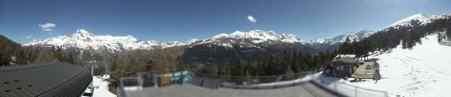
Termignon 2100m

Panoramique
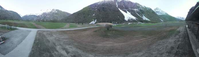
Carreley
TUESDAY
Apr 16

34° / 25°

8 - 16
mph
 2
2
WEDNESDAY
Apr 17

28° / 21°
6 - 14
mph
8
THURSDAY
Apr 18
26° / 22°
6 - 14
mph
12
FRIDAY
Apr 19

32° / 24°
5 - 12
mph
12
SATURDAY
Apr 20
39° / 28°
6 - 14
mph
9
SUNDAY
Apr 21
44° / 36°
4 - 12
mph
1
advertisement

Partly cloudy through the day and overnight, with periods of snow expected at any time.
Light snow through the day and into overnight with periods of moderate during the day. Snowfall is forecast to be 1 to 2 during the day, and a trace amount in the evening and overnight.
Potential Precip:
0.11 to 0.57
Hi: 34°Low: 25°
3,762 feet to 6579 feet
Winds W at 8 to 16 mph in the morning, becoming NW at 8 to 16 mph in the afternoon, and then NW at 7 to 15 mph overnight.
Cloudy becoming mostly cloudy in the late morning continuing through overnight, with periods of snow expected at any time.
Heavy snow during the day, becoming light in the evening through overnight. Snowfall is forecast to be 6 to 9 during the day, and 1 to 2 inches in the evening and overnight.
Potential Precip:
0.21 to 1.05
Hi: 28°Low: 21°
2,855 feet to 4811 feet
Winds NW at 6 to 14 mph through the day, becoming variable at 5 to 13 mph overnight.
Partly cloudy becoming mostly cloudy in the afternoon continuing through overnight. Periods of snow are expected at any time.
Periods of heavy snow throughout the day, light at times overnight. Snowfall is forecast to be 10 to 14 inches.
Potential Precip:
0.3 to 1.51
Hi: 26°Low: 22°
3,060 feet to 4314 feet
Winds variable at 4 to 12 mph in the morning, becoming NW at 6 to 14 mph in the afternoon, and then variable at 5 to 13 mph overnight.
Clear becoming partly cloudy in the evening continuing through overnight, with periods of snow expected in the evening through overnight.
Periods of light snow overnight. Snowfall is forecast to be 10 to 14 inches.
Potential Precip:
0.31 to 1.53
Hi: 32°Low: 24°
3,516 feet to 5965 feet
Winds variable at 5 to 12 mph through the day, becoming NW at 6 to 14 mph overnight.
Partly cloudy becoming mostly clear in the late morning continuing through overnight, with periods of snow expected in the morning through afternoon.
Periods of heavy snow throughout the day. Snowfall is forecast to be 8 to 11 inches.
Potential Precip:
0.31 to 1.55
Hi: 39°Low: 28°
4,886 feet to 7749 feet
Winds NW at 6 to 14 mph through the day, becoming variable at 4 to 12 mph overnight.
Mostly clear through the day and overnight.
Periods of snow throughout the day and overnight.
Potential Precip:
0.31 to 1.57
Hi: 44°Low: 36°
7,166 feet to 8717 feet
Winds variable at 4 to 12 mph through the day, becoming variable at 5 to 12 mph overnight.
 Sunrise & Sunset

Lunar Calendar


 Mid-Mountain


