 Stevens Pass... Summit @ Sno... Summit @ Sno... Summit @ Sno...
 Hauteville
  WebCams

Hauteville Terre Ronde
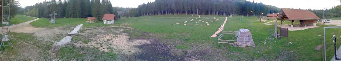
Hauteville La-praille
FRIDAY
Apr 19

47° / 34°

7 - 15
mph
 0
0
SATURDAY
Apr 20
37° / 33°
8 - 16
mph
2
SUNDAY
Apr 21

41° / 31°

13 - 22
mph
3
MONDAY
Apr 22
34° / 29°

9 - 17
mph
7
TUESDAY
Apr 23

46° / 34°
9 - 17
mph
4
WEDNESDAY
Apr 24
48° / 39°
12 - 23
mph
0
THURSDAY
Apr 25

54° / 38°
9 - 17
mph
0
advertisement

Clear becoming partly cloudy in the afternoon and then mostly cloudy overnight. Periods of rain are expected overnight.
No snow.
Potential Precip:
0.15 to 0.77
Hi: 47°Low: 34°
3,500 feet to 6351 feet
Winds variable at 4 to 12 mph in the morning, becoming NW at 7 to 15 mph in the afternoon, and then W at 11 to 20 mph overnight.
Cloudy becoming mostly cloudy in the afternoon continuing through overnight, with periods of snow expected at any time.
Light snow through the day and into overnight with periods of heavy during the day. Snowfall is forecast to be 2 to 3 during the day, and a trace amount in the evening and overnight.
Potential Precip:
0.22 to 1.11
Hi: 37°Low: 33°
3,002 feet to 4140 feet
Winds NW at 10 to 18 mph in the morning, becoming NW at 8 to 16 mph in the afternoon, and then NW at 6 to 14 mph overnight.
Mostly cloudy becoming partly cloudy in the late morning and then mostly cloudy overnight. Periods of rain and snow are expected overnight.
Snowfall is forecast to be 3 to 5 during the day, and a trace amount overnight.
Potential Precip:
0.28 to 1.39
Hi: 41°Low: 31°
2,483 feet to 4378 feet
Winds N at 9 to 17 mph in the morning, becoming N at 13 to 22 mph in the afternoon, and then W at 8 to 16 mph overnight.
Partly cloudy becoming mostly clear at times continuing through overnight, with periods of snow expected in the morning through evening.
Periods of moderate to heavy snow throughout the day. Snowfall is forecast to be 6 to 9 inches.
Potential Precip:
0.37 to 1.83
Hi: 34°Low: 29°
1,500 feet to 3455 feet
Winds N at 7 to 15 mph in the morning, becoming NW at 9 to 17 mph in the afternoon, and then E at 13 to 22 mph overnight.
Mostly clear becoming mostly cloudy at times continuing through overnight.
Periods of snow throughout the day and overnight.
Potential Precip:
0.37 to 1.83
Hi: 46°Low: 34°
1,856 feet to 5327 feet
Winds variable at 9 to 17 mph through the day, becoming variable at 11 to 20 mph overnight.
Mostly cloudy becoming mostly clear in the afternoon and then clear overnight. Periods of rain are expected in the morning.
No snow.
Potential Precip:
0.38 to 1.88
Hi: 48°Low: 39°
5,104 feet to 7664 feet
Winds variable at 12 to 23 mph through the day, becoming NE at 13 to 24 mph overnight.
Mostly clear becoming clear in the late morning continuing through overnight.
No snow.
Potential Precip:
0.38 to 1.88
Hi: 54°Low: 38°
6,618 feet to 8446 feet
Winds variable at 9 to 17 mph through the day, becoming variable at 11 to 20 mph overnight.
 Sunrise & Sunset

Lunar Calendar


advertisement
advertisement
 Mid-Mountain


