 Stevens Pass... Summit @ Sno... Summit @ Sno... Summit @ Sno...
 Mont Ripley
  Houghton County Memorial Airport, MI Updated Apr 23 @ 08:10
 North
North WebCams
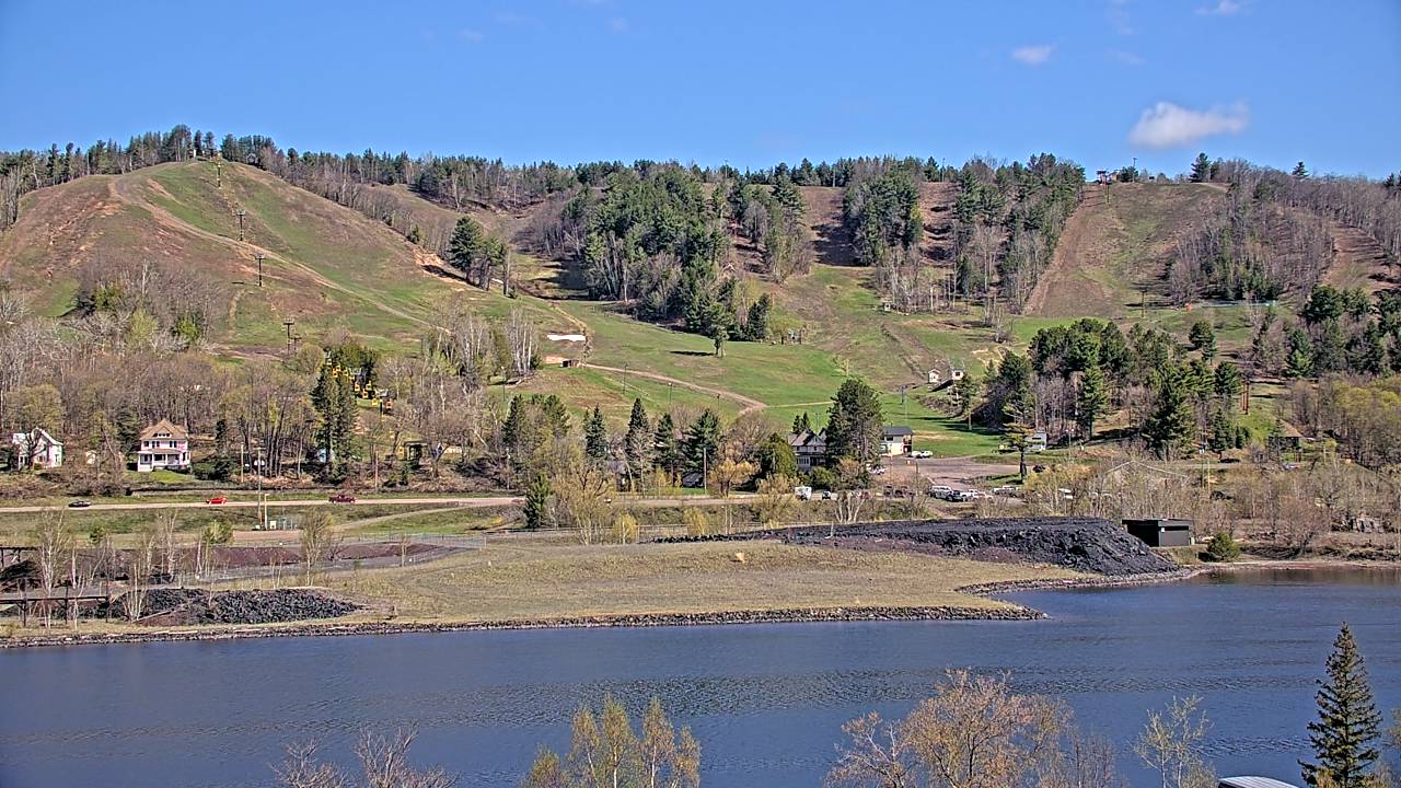
Ripley Cam—Still Image
Ripley Cam—Motion
TUESDAY
Apr 23

51° / 25°
16 - 27
mph
 0
0
WEDNESDAY
Apr 24

35° / 29°

8 - 16
mph
0
THURSDAY
Apr 25
52° / 40°

9 - 17
mph
0
FRIDAY
Apr 26

57° / 49°
15 - 26
mph
0
SATURDAY
Apr 27

65° / 35°
8 - 16
mph
0
SUNDAY
Apr 28
43° / 35°
14 - 25
mph
0
MONDAY
Apr 29
58° / 37°
7 - 15
mph
0
Mostly clear through the day and overnight.
Periods of light snow during the day. Snowfall is forecast to be a trace amount during the day.
Potential Precip:
0.01 to 0.04
Hi: 51°Low: 25°
0 feet to 5819 feet
Winds S at 13 to 24 mph with gusts to 30 in the morning, becoming NE at 16 to 27 mph in the afternoon, and then NE at 12 to 21 mph with gusts to 27 overnight.
Clear through the day and overnight, with windy conditions at times.
No snow.
No precipitation expected.
Hi: 35°Low: 29°
364 feet to 2945 feet
Winds E at 7 to 15 mph in the morning, becoming E at 8 to 16 mph in the afternoon, and then variable at 8 to 16 mph overnight.
Clear becoming mostly clear at times continuing through overnight, with windy conditions at times.
No snow.
No precipitation expected.
Hi: 52°Low: 40°
4,239 feet to 8937 feet
Winds S at 7 to 15 mph in the morning, becoming E at 9 to 17 mph in the afternoon, and then S at 13 to 22 mph with gusts to 33 overnight.
Mostly cloudy becoming cloudy in the late morning continuing through overnight, with periods of rain developing in the evening through overnight.
No snow.
Potential Precip:
0.09 to 0.45
Hi: 57°Low: 49°
9,297 feet to 10982 feet
Winds SE at 15 to 26 mph through the day, becoming SE at 9 to 17 mph with gusts to 31 overnight.
Mostly cloudy becoming cloudy in the evening continuing through overnight, with periods of rain and snow expected overnight.
Periods of light snow throughout the day and overnight. Snowfall is forecast to be a trace amount.
Potential Precip:
0.14 to 0.7
Hi: 65°Low: 35°
4,142 feet to 14599 feet
Winds variable at 8 to 16 mph with gusts to 25 through the day, becoming S at 11 to 20 mph overnight.
Cloudy becoming mostly cloudy in the late morning continuing through overnight, with periods of rain developing in the evening through overnight.
No snow.
Potential Precip:
0.08 to 0.39
Hi: 43°Low: 35°
1,396 feet to 14291 feet
Winds variable at 14 to 25 mph with gusts to 37 through the day, becoming variable at 12 to 21 mph with gusts to 42 overnight.
Mostly cloudy becoming cloudy in the evening continuing through overnight, with periods of rain and snow expected overnight.
Periods of light snow overnight. Snowfall is forecast to be a trace amount.
Potential Precip:
0.11 to 0.53
Hi: 58°Low: 37°
2,057 feet to 9946 feet
Winds variable at 7 to 15 mph with gusts to 37 through the day, becoming W at 13 to 24 mph with gusts to 38 overnight.
 Sunrise & Sunset

Lunar Calendar


 Mid-Mountain
  Snow Maps and Weather Stations in the Area


