 Mad River Mo... Nitehawk Ski... Clear Fork R... Snow Trails
 Mont Ripley
  Houghton County Memorial Airport, MI Updated Apr 20 @ 07:10

 Northwest
 WebCams
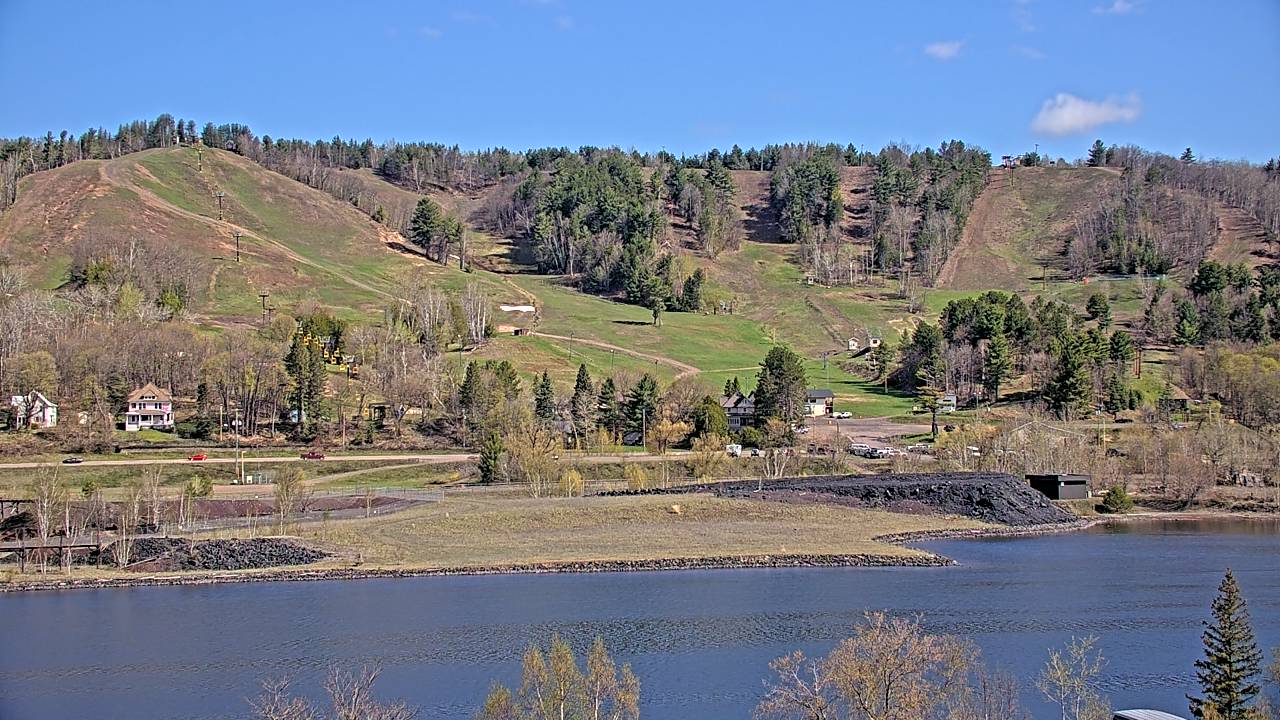
Ripley Cam—Still Image
Ripley Cam—Motion
SATURDAY
Apr 20

41° / 33°

16 - 27
mph
 0
0
SUNDAY
Apr 21

44° / 37°

12 - 21
mph
0
MONDAY
Apr 22

62° / 40°
12 - 21
mph
0
TUESDAY
Apr 23

33° / 20°
16 - 27
mph
1
WEDNESDAY
Apr 24

30° / 24°
10 - 18
mph
0
THURSDAY
Apr 25
43° / 35°
9 - 17
mph
0
FRIDAY
Apr 26
51° / 40°
10 - 19
mph
0
Partly cloudy becoming mostly clear in the evening continuing through overnight, with periods of snow expected in the morning.
Periods of light snow during the day. Snowfall is forecast to be a trace amount during the day.
Potential Precip:
0 to 0.02
Hi: 41°Low: 33°
934 feet to 3115 feet
Winds W at 17 to 28 mph in the morning, becoming W at 16 to 27 mph with gusts to 33 in the afternoon, and then W at 13 to 24 mph with gusts to 31 overnight.
Mostly cloudy becoming mostly clear in the afternoon continuing through overnight.
No snow.
Potential Precip:
0 to 0.01
Hi: 44°Low: 37°
1,790 feet to 5373 feet
Winds NW at 15 to 26 mph in the morning, becoming NW at 12 to 21 mph in the afternoon, and then SW at 9 to 17 mph with gusts to 27 overnight.
Partly cloudy becoming cloudy in the late morning and then mostly cloudy overnight. Periods of rain are expected in the evening through overnight.
No snow.
Potential Precip:
0.13 to 0.65
Hi: 62°Low: 40°
5,603 feet to 6692 feet
Winds SW at 12 to 21 mph through the day, becoming SW at 9 to 17 mph with gusts to 28 overnight.
Cloudy becoming mostly clear overnight continuing through overnight, with periods of snow expected in the morning through evening.
Periods of light to moderate snow throughout the day. Snowfall is forecast to be 1 to 2 inches.
Potential Precip:
0.03 to 0.17
Hi: 33°Low: 20°
0 feet to 1067 feet
Winds NE at 13 to 24 mph in the morning, becoming NE at 16 to 27 mph in the afternoon, and then N at 14 to 23 mph overnight.
Mostly clear becoming mostly cloudy at times continuing through overnight, with windy conditions at times.
No snow.
No precipitation expected.
Hi: 30°Low: 24°
0 feet to 393 feet
Winds S at 10 to 18 mph through the day, becoming variable at 5 to 12 mph overnight.
Mostly cloudy becoming clear in the late morning and then mostly clear overnight. Expect windy conditions at times.
No snow.
No precipitation expected.
Hi: 43°Low: 35°
1,549 feet to 4639 feet
Winds E at 9 to 17 mph through the day, becoming variable at 10 to 18 mph overnight.
Mostly clear becoming mostly cloudy at times continuing through overnight. Periods of rain are expected overnight.
No snow.
Potential Precip:
0.01 to 0.07
Hi: 51°Low: 40°
4,379 feet to 6887 feet
Winds SE at 10 to 19 mph through the day, becoming E at 13 to 22 mph with gusts to 33 overnight.
 Sunrise & Sunset

Lunar Calendar


advertisement

 Mid-Mountain
  Snow Maps and Weather Stations in the Area


