 Mt Waterman Mountain Hig... Mt Baldy Alta Sierra...
 Les Egaux
  WebCams

Webcam-ski-alpin
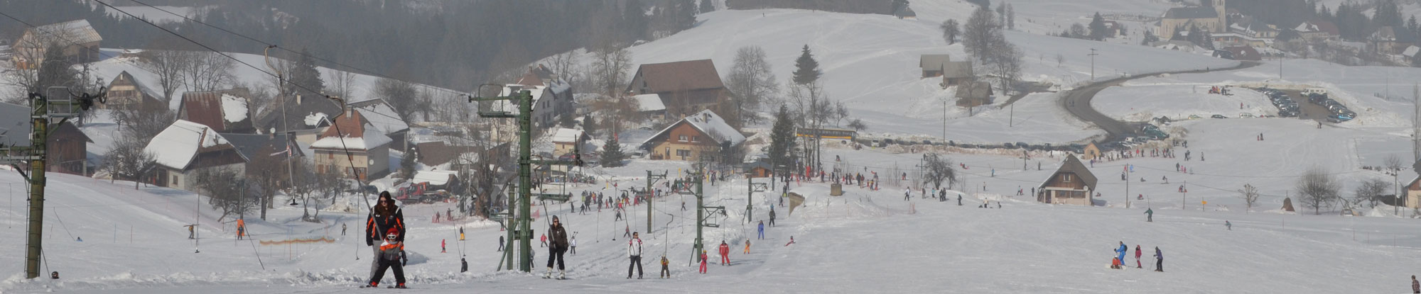
Webcam de la station
SUNDAY
Jul 19

55° / 46°

5 - 12
mph
 0
0
MONDAY
Jul 20

53° / 45°
4 - 11
mph
0
TUESDAY
Jul 21
55° / 45°
4 - 12
mph
0
WEDNESDAY
Jul 22

49° / 42°
5 - 12
mph
0
THURSDAY
Jul 23

47° / 37°
4 - 11
mph
0
FRIDAY
Jul 24
51° / 44°

3 - 11
mph
0
Mostly clear becoming partly cloudy at times and then mostly clear overnight. Periods of rain are expected in the morning.
No snow.
Potential Precip:
0 to 0.01
Hi: 55°Low: 46°
9,725 feet to 10214 feet
Winds variable at 5 to 12 mph through the day, becoming variable at 4 to 11 mph overnight.
Mostly clear becoming clear in the afternoon continuing through overnight.
No snow.
Potential Precip:
0 to 0.01
Hi: 53°Low: 45°
9,214 feet to 9872 feet
Winds variable at 5 to 12 mph in the morning, becoming variable at 4 to 11 mph in the afternoon, and then variable at 5 to 12 mph overnight.
Mostly clear becoming clear in the afternoon and then mostly clear overnight.
No snow.
Potential Precip:
0 to 0.01
Hi: 55°Low: 45°
8,707 feet to 9911 feet
Winds variable at 4 to 12 mph throughout the day and into overnight.
Partly cloudy becoming mostly cloudy in the late morning continuing through overnight, with periods of rain expected in the morning.
No snow.
Potential Precip:
0 to 0.01
Hi: 49°Low: 42°
5,956 feet to 8484 feet
Winds variable at 5 to 12 mph throughout the day and into overnight.
Mostly cloudy through the day and overnight, with periods of rain and snow expected overnight.
Periods of light snow throughout the day. Snowfall is forecast to be a trace amount.
Potential Precip:
0.01 to 0.03
Hi: 47°Low: 37°
5,388 feet to 7421 feet
Winds variable at 4 to 11 mph throughout the day and into overnight.
Mostly cloudy through the day and overnight, with periods of rain expected in the morning through evening.
No snow.
Potential Precip:
0.01 to 0.04
Hi: 51°Low: 44°
6,842 feet to 7982 feet
Winds variable at 3 to 11 mph through the day, becoming variable at 4 to 11 mph overnight.
 Sunrise & Sunset

Lunar Calendar


 Mid-Mountain


