 Mt Waterman Mt Baldy Mountain Hig... Snow Valley...
 Orcieres Merlette 1850
  WebCams
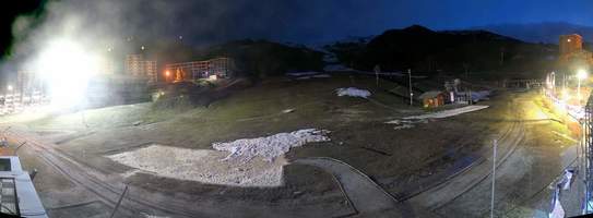
ORCIERES MERLETTE 1850 : FRONT DE NEIGE

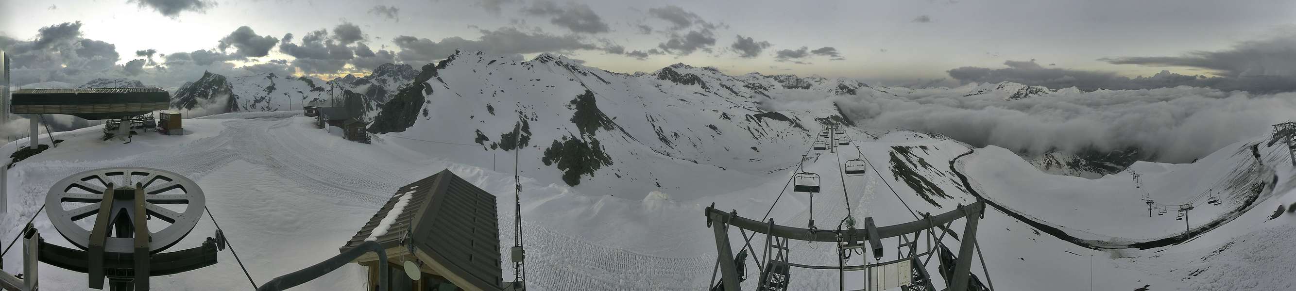
ORCIERES MERLETTE 1850 : ROCHEROUSSE
ORCIERES MERLETTE 1850 : LE DROUVET
TUESDAY
Jul 14

42° / 37°

5 - 12
mph
 0
0
WEDNESDAY
Jul 15

41° / 36°
4 - 11
mph
0
THURSDAY
Jul 16
40° / 34°
5 - 12
mph
0
FRIDAY
Jul 17

37° / 31°
5 - 12
mph
0
SATURDAY
Jul 18
38° / 32°
4 - 11
mph
0
SUNDAY
Jul 19

39° / 34°
4 - 12
mph
0
Mostly clear becoming partly cloudy at times and then mostly clear overnight. Periods of rain are expected in the morning through evening.
No snow.
Potential Precip:
0 to 0.02
Hi: 42°Low: 37°
9,857 feet to 10099 feet
Winds variable at 5 to 12 mph through the day, becoming variable at 4 to 11 mph overnight.
Mostly clear through the day and overnight.
Scattered snow showers possible.
Potential Precip:
0.01 to 0.04
Hi: 41°Low: 36°
5,563 feet to 10376 feet
Winds variable at 5 to 12 mph in the morning, becoming variable at 4 to 11 mph in the afternoon through overnight.
Mostly clear becoming clear in the afternoon and then mostly clear overnight. Periods of rain and snow are expected overnight.
Periods of snow throughout the day and overnight.
Potential Precip:
0.01 to 0.05
Hi: 40°Low: 34°
4,811 feet to 11536 feet
Winds variable at 5 to 12 mph throughout the day and into overnight.
Mostly cloudy becoming mostly clear overnight continuing through overnight, with periods of snow expected in the morning through evening.
Periods of light snow throughout the day. Snowfall is forecast to be a trace amount.
Potential Precip:
0.01 to 0.06
Hi: 37°Low: 31°
6,072 feet to 8231 feet
Winds variable at 5 to 12 mph through the day, becoming variable at 4 to 11 mph overnight.
Partly cloudy becoming mostly cloudy in the evening continuing through overnight, with periods of snow expected in the morning through evening.
Periods of light snow throughout the day. Snowfall is forecast to be a trace amount.
Potential Precip:
0.01 to 0.06
Hi: 38°Low: 32°
6,725 feet to 7431 feet
Winds variable at 4 to 11 mph through the day, becoming variable at 4 to 12 mph overnight.
Partly cloudy through the day and overnight, with periods of snow expected in the morning through evening.
Periods of light snow throughout the day. Snowfall is forecast to be a trace amount.
Potential Precip:
0.02 to 0.1
Hi: 39°Low: 34°
4,929 feet to 7767 feet
Winds variable at 4 to 12 mph throughout the day and into overnight.
 Sunrise & Sunset

Lunar Calendar


 Mid-Mountain


