 Mt Waterman Mountain Hig... Mt Baldy Alta Sierra...
 Falls Creek Resort
  WebCams
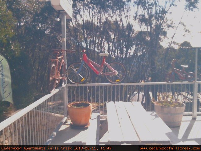
Cedarwood Balcony
WEDNESDAY
Jun 10

72° / 63°

4 - 11
mph
 0
0
THURSDAY
Jun 11
67° / 62°
4 - 11
mph
0
FRIDAY
Jun 12

79° / 64°

0 - 0
mph
0
SATURDAY
Jun 13
78° / 66°
4 - 11
mph
0
SUNDAY
Jun 14

71° / 67°
4 - 11
mph
0
MONDAY
Jun 15
82° / 69°
5 - 12
mph
0
Mostly cloudy through the day and overnight, with periods of rain expected in the morning through overnight.
No snow.
Potential Precip:
0.32 to 1.58
Hi: 59°Low: 50°
13,387 feet to 14232 feet
Winds variable at 12 to 21 mph with gusts to 29 in the morning, becoming variable at 7 to 15 mph in the afternoon, and then S at 7 to 15 mph overnight.
Mostly cloudy becoming partly cloudy overnight continuing through overnight, with periods of rain expected in the morning through overnight.
No snow.
Potential Precip:
0.37 to 1.83
Hi: 59°Low: 54°
13,387 feet to 14232 feet
Winds NW at 17 to 28 mph with gusts to 35 in the morning, becoming W at 12 to 21 mph in the afternoon, and then variable at 7 to 15 mph overnight.
Mostly cloudy becoming partly cloudy at times continuing through overnight, with periods of rain developing in the afternoon through overnight.
No snow.
Potential Precip:
0.01 to 0.07
Hi: 51°Low: 50°
12,962 feet to 13960 feet
Winds E at 9 to 17 mph in the morning, becoming variable at 5 to 13 mph in the afternoon, and then variable at 4 to 12 mph overnight.
Partly cloudy becoming mostly cloudy at times continuing through overnight. Periods of rain are expected overnight.
No snow.
Potential Precip:
0.01 to 0.07
Hi: 54°Low: 52°
12,962 feet to 13960 feet
Winds variable at 7 to 15 mph in the morning, becoming S at 8 to 16 mph in the afternoon, and then SW at 6 to 14 mph overnight.
Mostly cloudy becoming partly cloudy in the late morning continuing through overnight, with periods of rain expected in the morning through overnight.
No snow.
Potential Precip:
0.14 to 0.68
Hi: 56°Low: 51°
12,638 feet to 13318 feet
Winds variable at 5 to 12 mph through the day, becoming variable at 5 to 13 mph overnight.
Partly cloudy becoming mostly clear in the evening continuing through overnight, with periods of rain expected in the afternoon.
No snow.
Potential Precip:
0.14 to 0.72
Hi: 54°Low: 53°
12,638 feet to 13318 feet
Winds variable at 5 to 13 mph in the morning, becoming NW at 6 to 14 mph in the afternoon, and then variable at 5 to 13 mph overnight.
Partly cloudy becoming mostly cloudy at times and then cloudy overnight. Periods of rain are expected overnight.
No snow.
Potential Precip:
0.11 to 0.53
Hi: 56°Low: 55°
12,379 feet to 13229 feet
Winds variable at 4 to 12 mph in the morning, becoming variable at 4 to 11 mph in the afternoon, and then variable at 4 to 12 mph overnight.
Mostly cloudy becoming cloudy in the evening continuing through overnight, with periods of rain expected overnight.
No snow.
Potential Precip:
0.18 to 0.89
Hi: 54°Low: 53°
12,379 feet to 13229 feet
Winds variable at 4 to 12 mph in the morning, becoming variable at 4 to 11 mph in the afternoon, and then variable at 4 to 12 mph overnight.
Cloudy through the day and overnight, with periods of rain developing in the morning through overnight.
No snow.
Potential Precip:
0.07 to 0.33
Hi: 55°Low: 51°
11,991 feet to 12347 feet
Winds variable at 8 to 16 mph through the day, becoming variable at 15 to 26 mph overnight.
Cloudy becoming mostly cloudy at times continuing through overnight, with periods of rain developing in the afternoon through overnight.
No snow.
Potential Precip:
0.11 to 0.55
Hi: 54°Low: 50°
11,991 feet to 12347 feet
Winds variable at 10 to 19 mph through the day, becoming variable at 20 to 31 mph overnight.
Mostly cloudy becoming partly cloudy in the afternoon continuing through overnight, with periods of rain expected in the morning through overnight.
No snow.
Potential Precip:
0.04 to 0.22
Hi: 58°Low: 55°
12,461 feet to 13547 feet
Winds N at 15 to 26 mph through the day, becoming NW at 11 to 20 mph overnight.
Cloudy becoming mostly clear at times and then partly cloudy overnight. Periods of rain are expected in the morning through overnight.
No snow.
Potential Precip:
0.03 to 0.15
Hi: 56°Low: 52°
12,461 feet to 13547 feet
Winds variable at 22 to 33 mph through the day, becoming NW at 14 to 25 mph overnight.
Mostly cloudy becoming mostly clear at times continuing through overnight. Periods of rain are expected in the afternoon.
No snow.
Potential Precip:
0.08 to 0.4
Hi: 60°Low: 59°
Winds NW at 9 to 17 mph through the day, becoming variable at 5 to 13 mph overnight.
Cloudy becoming partly cloudy in the late morning continuing through overnight, with periods of rain developing in the afternoon through overnight.
No snow.
Potential Precip:
0.03 to 0.15
Hi: 57°Low: 54°
Winds variable at 12 to 21 mph through the day, becoming variable at 7 to 15 mph overnight.
 Sunrise & Sunset

Lunar Calendar


 Mountain Base


