 Mt Waterman Mountain Hig... Mt Baldy Alta Sierra...
 Le Semnoz
  WebCams
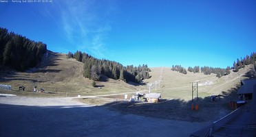
Semnoz Versant

Semnoz Nordique-Foret
SUNDAY
Jul 5

57° / 43°

4 - 12
mph
 0
0
MONDAY
Jul 6
58° / 44°
4 - 11
mph
0
TUESDAY
Jul 7
59° / 45°
4 - 11
mph
0
WEDNESDAY
Jul 8
59° / 45°
5 - 12
mph
0
THURSDAY
Jul 9
55° / 43°
5 - 12
mph
0
FRIDAY
Jul 10

52° / 42°
4 - 11
mph
0
SATURDAY
Jul 11
56° / 42°
4 - 11
mph
0
Clear becoming mostly clear in the afternoon continuing through overnight, with windy conditions at times.
No snow.
No precipitation expected.
Hi: 57°Low: 43°
8,679 feet to 10432 feet
Winds variable at 5 to 12 mph in the morning, becoming variable at 4 to 12 mph in the afternoon through overnight.
Partly cloudy becoming mostly clear at times continuing through overnight, with windy conditions at times.
No snow.
No precipitation expected.
Hi: 58°Low: 44°
9,699 feet to 10194 feet
Winds variable at 4 to 11 mph throughout the day and into overnight.
Mostly clear becoming clear in the afternoon continuing through overnight, with windy conditions at times.
No snow.
No precipitation expected.
Hi: 59°Low: 45°
9,142 feet to 9607 feet
Winds variable at 4 to 11 mph throughout the day and into overnight.
Clear becoming mostly clear at times continuing through overnight. Expect windy conditions at times.
No snow.
No precipitation expected.
Hi: 59°Low: 45°
8,588 feet to 9566 feet
Winds calm in the morning, becoming variable at 5 to 12 mph in the afternoon through overnight.
Partly cloudy becoming cloudy at times continuing through overnight, with windy conditions at times.
No snow.
No precipitation expected.
Hi: 55°Low: 43°
5,923 feet to 8287 feet
Winds variable at 5 to 12 mph through the day, becoming variable at 4 to 12 mph overnight.
Mostly cloudy through the day and overnight, with periods of rain expected in the morning.
No snow.
Potential Precip:
0.01 to 0.03
Hi: 52°Low: 42°
5,304 feet to 7396 feet
Winds variable at 4 to 11 mph through the day, becoming variable at 4 to 12 mph overnight.
Cloudy becoming mostly cloudy overnight continuing through overnight, with periods of rain expected in the morning through evening.
No snow.
Potential Precip:
0.01 to 0.05
Hi: 56°Low: 42°
6,916 feet to 8090 feet
Winds variable at 4 to 11 mph through the day, becoming variable at 5 to 12 mph overnight.
 Sunrise & Sunset

Lunar Calendar


 Mid-Mountain


