 Mt Waterman Mountain Hig... Mt Baldy Alta Sierra...
 Megeve/Saint-Gervais
  WebCams
Cote 2000 Altiport
CROIX DU CHRIST
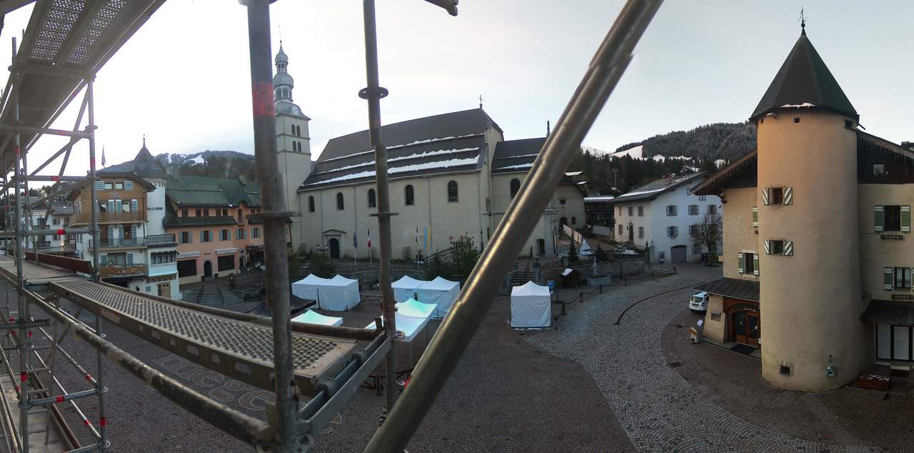
La place du village
MONDAY
Apr 6

45° / 38°

5 - 12
mph
 0
0
TUESDAY
Apr 7
50° / 41°
5 - 12
mph
0
WEDNESDAY
Apr 8
49° / 41°

0 - 0
mph
0
THURSDAY
Apr 9
49° / 41°
5 - 12
mph
0
FRIDAY
Apr 10

46° / 38°
5 - 12
mph
0
SATURDAY
Apr 11

45° / 37°
4 - 11
mph
0
SUNDAY
Apr 12
50° / 40°

3 - 11
mph
0
Clear becoming mostly clear in the afternoon continuing through overnight.
No snow.
Potential Precip:
0 to 0.01
Hi: 45°Low: 38°
8,506 feet to 10497 feet
Winds variable at 4 to 12 mph in the morning, becoming variable at 5 to 12 mph in the afternoon through overnight.
Clear becoming mostly clear at times and then partly cloudy overnight. Periods of rain are expected in the afternoon.
No snow.
Potential Precip:
0 to 0.01
Hi: 50°Low: 41°
9,817 feet to 10313 feet
Winds variable at 4 to 12 mph in the morning, becoming variable at 5 to 12 mph in the afternoon through overnight.
Mostly clear becoming clear in the evening continuing through overnight.
No snow.
Potential Precip:
0 to 0.02
Hi: 49°Low: 41°
9,104 feet to 9680 feet
Winds variable at 5 to 12 mph in the morning, becoming calm in the afternoon, and then variable at 4 to 11 mph overnight.
Clear becoming mostly clear at times continuing through overnight.
No snow.
Potential Precip:
0 to 0.02
Hi: 49°Low: 41°
8,666 feet to 9746 feet
Winds variable at 5 to 12 mph through the day, becoming variable at 4 to 12 mph overnight.
Mostly cloudy through the day and overnight, with periods of rain expected in the morning.
No snow.
Potential Precip:
0 to 0.02
Hi: 46°Low: 38°
6,115 feet to 8422 feet
Winds variable at 5 to 12 mph throughout the day and into overnight.
Mostly cloudy through the day and overnight, with periods of rain and snow expected overnight.
Periods of light snow throughout the day. Snowfall is forecast to be a trace amount.
Potential Precip:
0.01 to 0.04
Hi: 45°Low: 37°
5,592 feet to 7423 feet
Winds variable at 4 to 11 mph throughout the day and into overnight.
Cloudy becoming partly cloudy in the late morning and then cloudy overnight. Periods of rain are expected in the morning through overnight.
No snow.
Potential Precip:
0.02 to 0.1
Hi: 50°Low: 40°
6,979 feet to 8236 feet
Winds variable at 3 to 11 mph through the day, becoming variable at 5 to 12 mph overnight.
 Sunrise & Sunset

Lunar Calendar


 Mid-Mountain


