 Mt Waterman Mountain Hig... Mt Baldy Alta Sierra...
 Menthieres
  WebCams
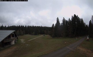
Mont Jura La Vattay - 1300m
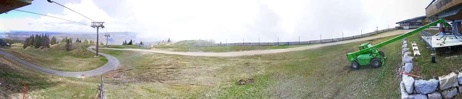
La Faucille - 1540m
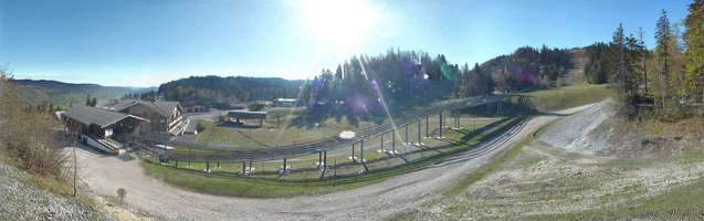
La Faucille - Coeur de Station
SUNDAY
Mar 29

49° / 42°

5 - 13
mph
 0
0
MONDAY
Mar 30
50° / 46°
5 - 12
mph
0
TUESDAY
Mar 31
49° / 47°
5 - 12
mph
0
WEDNESDAY
Apr 1
49° / 44°
7 - 15
mph
0
THURSDAY
Apr 2

43° / 33°

10 - 19
mph
0
FRIDAY
Apr 3

41° / 33°

3 - 11
mph
0
SATURDAY
Apr 4

46° / 41°
6 - 14
mph
0
Mostly clear through the day and overnight, with windy conditions at times.
No snow.
No precipitation expected.
Hi: 49°Low: 42°
8,356 feet to 10379 feet
Winds variable at 6 to 14 mph in the morning, becoming variable at 5 to 13 mph in the afternoon through overnight.
Mostly clear becoming mostly cloudy at times and then mostly clear overnight. Expect windy conditions at times.
No snow.
No precipitation expected.
Hi: 50°Low: 46°
9,250 feet to 10018 feet
Winds variable at 4 to 12 mph in the morning, becoming variable at 5 to 12 mph in the afternoon, and then S at 6 to 14 mph overnight.
Mostly clear becoming clear in the evening continuing through overnight, with windy conditions at times.
No snow.
No precipitation expected.
Hi: 49°Low: 47°
9,132 feet to 9523 feet
Winds SW at 7 to 15 mph in the morning, becoming variable at 5 to 12 mph in the afternoon through overnight.
Clear through the day becoming mostly clear overnight. Expect windy conditions at times.
No snow.
No precipitation expected.
Hi: 49°Low: 44°
8,259 feet to 9455 feet
Winds S at 6 to 14 mph in the morning, becoming S at 7 to 15 mph in the afternoon, and then S at 10 to 19 mph overnight.
Partly cloudy becoming cloudy at times continuing through overnight, with periods of snow expected overnight.
Periods of light snow overnight. Snowfall is forecast to be a trace amount.
Potential Precip:
0.03 to 0.14
Hi: 43°Low: 33°
4,421 feet to 8049 feet
Winds S at 10 to 19 mph through the day, becoming W at 9 to 17 mph overnight.
Mostly cloudy becoming clear at times and then partly cloudy overnight. Periods of snow are expected in the morning.
Periods of snow throughout the day and overnight.
Potential Precip:
0.03 to 0.14
Hi: 41°Low: 33°
4,487 feet to 7519 feet
Winds variable at 3 to 11 mph through the day, becoming SE at 6 to 14 mph overnight.
Mostly cloudy becoming partly cloudy in the late morning continuing through overnight, with windy conditions at times.
No snow.
No precipitation expected.
Hi: 46°Low: 41°
6,494 feet to 7782 feet
Winds SE at 6 to 14 mph through the day, becoming S at 9 to 17 mph with gusts to 26 overnight.
 Sunrise & Sunset

Lunar Calendar


 Mid-Mountain


