 Soldier Moun...
  Mt Waterman Mountain Hig... Mt Baldy
 Mount Washington Alpine
  WebCams
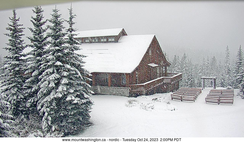
Nordic
TUESDAY
Apr 7

32° / 25°

4 - 12
mph
 0
0
WEDNESDAY
Apr 8

31° / 27°
8 - 16
mph
6
THURSDAY
Apr 9
30° / 24°
7 - 15
mph
1
FRIDAY
Apr 10
26° / 23°
4 - 11
mph
0
SATURDAY
Apr 11

34° / 28°
4 - 11
mph
0
SUNDAY
Apr 12
36° / 34°
4 - 12
mph
0
MONDAY
Apr 13
36° / 34°
5 - 13
mph
0
Partly cloudy becoming mostly clear in the afternoon and then partly cloudy overnight. Periods of snow are expected overnight.
Snowfall is forecast to be a trace amount during the day, and a trace amount overnight.
Potential Precip:
0 to 0.02
Hi: 27°Low: 24°
1,138 feet to 4055 feet
Winds variable at 4 to 12 mph through the day, becoming W at 7 to 15 mph overnight.
Partly cloudy through the day becoming mostly cloudy overnight. Periods of snow are expected in the afternoon.
Periods of light snow during the day. Snowfall is forecast to be a trace amount during the day.
Potential Precip:
0 to 0.01
Hi: 25°Low: 24°
1,138 feet to 4055 feet
Winds W at 8 to 16 mph in the morning, becoming W at 10 to 18 mph in the afternoon, and then W at 10 to 19 mph overnight.
Mostly cloudy becoming cloudy at times and then mostly cloudy overnight. Periods of snow are expected at any time.
Moderate snow with periods of heavy during the day, becoming heavy in the evening and moderate overnight. Snowfall is forecast to be 3 to 5 during the day, and 3 to 6 inches in the evening and overnight.
Potential Precip:
0.24 to 1.21
Hi: 28°Low: 24°
2,652 feet to 3596 feet
Winds W at 10 to 19 mph in the morning, becoming SW at 10 to 19 mph in the afternoon, and then SW at 11 to 20 mph overnight.
Mostly cloudy becoming cloudy at times continuing through overnight. Periods of snow are expected at any time.
Light snow through the day and into overnight. Snowfall is forecast to be a trace amount during the day, and 1 to 2 inches in the evening and overnight.
Potential Precip:
0.04 to 0.22
Hi: 27°Low: 25°
2,652 feet to 3596 feet
Winds SW at 11 to 20 mph in the morning, becoming SW at 12 to 21 mph in the afternoon through overnight.
Mostly cloudy becoming partly cloudy in the evening continuing through overnight, with periods of snow expected at any time.
Light snow through the day and into overnight with periods of moderate during the day. Snowfall is forecast to be 1 to 2 during the day, and a trace amount in the evening and overnight.
Potential Precip:
0.04 to 0.21
Hi: 26°Low: 21°
1,681 feet to 3462 feet
Winds SW at 10 to 19 mph in the morning, becoming W at 8 to 16 mph in the afternoon through overnight.
Partly cloudy through the day and overnight, with periods of snow expected at any time.
Light snow through the day and into overnight. Snowfall is forecast to be 1 to 2 during the day, and a trace amount in the evening and overnight.
Potential Precip:
0.02 to 0.11
Hi: 27°Low: 21°
1,681 feet to 3462 feet
Winds SW at 14 to 23 mph in the morning, becoming W at 12 to 21 mph with gusts to 27 in the afternoon, and then W at 11 to 20 mph overnight.
Mostly cloudy becoming partly cloudy in the late morning continuing through overnight, with periods of snow expected in the morning through evening.
Periods of light snow throughout the day. Snowfall is forecast to be 1 to 2 inches.
Potential Precip:
0.01 to 0.06
Hi: 24°Low: 22°
0 feet to 2797 feet
Winds W at 7 to 15 mph in the morning, becoming variable at 5 to 12 mph in the afternoon through overnight.
Cloudy becoming partly cloudy in the afternoon continuing through overnight. Periods of snow are expected in the morning through evening.
Periods of light to moderate snow throughout the day. Snowfall is forecast to be 1 to 2 inches.
Potential Precip:
0.02 to 0.1
Hi: 23°Low: 19°
0 feet to 2797 feet
Winds W at 10 to 19 mph through the day, becoming NW at 6 to 14 mph overnight.
Mostly clear through the day and overnight, with windy conditions at times.
No snow.
No precipitation expected.
Hi: 33°Low: 25°
1,006 feet to 6665 feet
Winds variable at 4 to 11 mph through the day, becoming variable at 4 to 12 mph overnight.
Mostly clear through the day and overnight, with windy conditions at times.
No snow.
No precipitation expected.
Hi: 33°Low: 23°
1,006 feet to 6665 feet
Winds W at 6 to 14 mph through the day, becoming W at 10 to 19 mph with gusts to 26 overnight.
Mostly clear becoming partly cloudy overnight continuing through overnight, with windy conditions at times.
No snow.
No precipitation expected.
Hi: 35°Low: 31°
2,006 feet to 10584 feet
Winds variable at 5 to 13 mph through the day, becoming W at 6 to 14 mph overnight.
Mostly clear through the day becoming partly cloudy overnight. Expect windy conditions at times.
No snow.
No precipitation expected.
Hi: 35°Low: 31°
2,006 feet to 10584 feet
Winds W at 13 to 22 mph throughout the day and into overnight.
Mostly clear through the day and overnight, with windy conditions at times.
No snow.
No precipitation expected.
Hi: 34°Low: 31°
1,427 feet to 7809 feet
Winds W at 7 to 15 mph through the day, becoming W at 6 to 14 mph overnight.
Mostly clear becoming partly cloudy in the late morning continuing through overnight, with windy conditions at times.
No snow.
No precipitation expected.
Hi: 32°Low: 29°
1,427 feet to 7809 feet
Winds W at 13 to 22 mph with gusts to 31 through the day, becoming W at 10 to 18 mph with gusts to 28 overnight.
 Sunrise & Sunset

Lunar Calendar


 Snow Maps and Weather Stations in the Area
 ![]() 9in, past 7 days. Snow surface is packed powder and variable conditions
9in, past 7 days. Snow surface is packed powder and variable conditions
Snow report provided by SnoCountry
 Mountain Base


