 Porte de la...
  Mt Waterman Mountain Hig... Mt Baldy
 SAEM Lioran Developpement
  WebCams

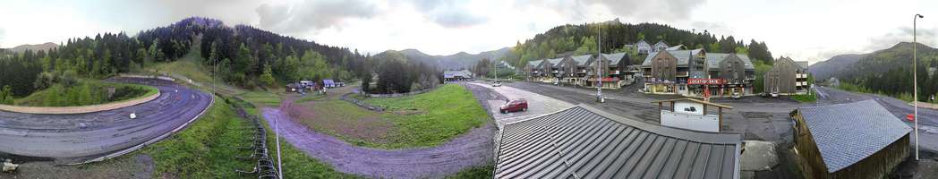
Sommet Domaine
Font d'Alagon
SUNDAY
Mar 29
54° / 50°

5 - 12
mph
 0
0
MONDAY
Mar 30
52° / 47°

10 - 18
mph
0
TUESDAY
Mar 31

51° / 47°
4 - 11
mph
0
WEDNESDAY
Apr 1
51° / 39°
10 - 19
mph
0
THURSDAY
Apr 2

37° / 32°
10 - 19
mph
1
FRIDAY
Apr 3
43° / 35°
6 - 14
mph
0
SATURDAY
Apr 4

43° / 40°

23 - 34
mph
0
Partly cloudy through the day and overnight, with windy conditions at times.
No snow.
No precipitation expected.
Hi: 54°Low: 50°
9,964 feet to 10521 feet
Winds variable at 4 to 12 mph in the morning, becoming variable at 5 to 12 mph in the afternoon, and then SE at 7 to 15 mph overnight.
Partly cloudy becoming mostly clear at times and then partly cloudy overnight. Expect windy conditions at times.
No snow.
No precipitation expected.
Hi: 52°Low: 47°
9,559 feet to 10258 feet
Winds SE at 9 to 17 mph in the morning, becoming SE at 10 to 18 mph in the afternoon, and then SE at 9 to 17 mph overnight.
Mostly clear becoming clear in the late morning continuing through overnight. Expect windy conditions at times.
No snow.
No precipitation expected.
Hi: 51°Low: 47°
9,471 feet to 9603 feet
Winds variable at 4 to 12 mph in the morning, becoming variable at 4 to 11 mph in the afternoon, and then variable at 4 to 12 mph overnight.
Clear becoming partly cloudy at times continuing through overnight, with windy conditions at times.
No snow.
No precipitation expected.
Hi: 51°Low: 39°
8,415 feet to 9486 feet
Winds S at 9 to 17 mph in the morning, becoming S at 10 to 19 mph in the afternoon, and then S at 13 to 24 mph overnight.
Cloudy becoming mostly cloudy at times continuing through overnight, with periods of snow expected at any time.
Periods of light snow throughout the day and overnight. Snowfall is forecast to be 1 to 2 inches.
Potential Precip:
0.08 to 0.39
Hi: 37°Low: 32°
4,187 feet to 6759 feet
Winds variable at 10 to 19 mph through the day, becoming W at 8 to 16 mph overnight.
Mostly clear becoming clear in the late morning continuing through overnight. Expect windy conditions at times.
No snow.
No precipitation expected.
Hi: 43°Low: 35°
5,046 feet to 7589 feet
Winds E at 6 to 14 mph through the day, becoming SE at 20 to 31 mph overnight.
Mostly cloudy becoming cloudy at times and then partly cloudy overnight. Periods of rain are expected in the evening.
No snow.
Potential Precip:
0 to 0.01
Hi: 43°Low: 40°
6,970 feet to 7458 feet
Winds SE at 23 to 34 mph through the day, becoming SE at 20 to 31 mph overnight.
 Sunrise & Sunset

Lunar Calendar


 Mid-Mountain


