 Whitefish Mo...
  Kendall Moun... Mt Waterman
  Mountain Hig...
 Mission Ridge Ski Area
  BLEWETT PASS, WA Updated Jul 18 @ 04:14

 North
North WebCams

SunSpot Cam

Micro Cam

Midway Cam
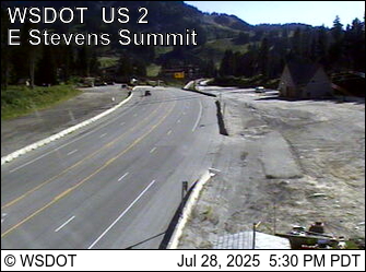
Stevens Pass/ Summit
FRIDAY
Jul 18
68° / 52°

15 - 26
mph
 0
0
SATURDAY
Jul 19
61° / 52°
16 - 27
mph
0
SUNDAY
Jul 20

61° / 55°

10 - 19
mph
0
MONDAY
Jul 21
62° / 59°

5 - 13
mph
0
TUESDAY
Jul 22
69° / 65°
7 - 15
mph
0
WEDNESDAY
Jul 23
72° / 64°
8 - 16
mph
0
THURSDAY
Jul 24
73° / 61°
10 - 19
mph
0
Cloudy becoming clear in the afternoon and then mostly clear overnight. Expect windy conditions at times.
No snow.
No precipitation expected.
Hi: 68°Low: 52°
12,338 feet to 13270 feet
Winds W at 11 to 20 mph in the morning, becoming NW at 15 to 26 mph in the afternoon, and then NW at 9 to 17 mph overnight.
Partly cloudy becoming clear at times continuing through overnight, with windy conditions at times.
No snow.
No precipitation expected.
Hi: 61°Low: 52°
10,840 feet to 12911 feet
Winds W at 9 to 17 mph in the morning, becoming NW at 16 to 27 mph in the afternoon, and then NW at 9 to 17 mph overnight.
Partly cloudy becoming mostly clear in the late morning continuing through overnight, with windy conditions at times.
No snow.
No precipitation expected.
Hi: 61°Low: 55°
10,717 feet to 11101 feet
Winds variable at 5 to 13 mph in the morning, becoming S at 10 to 19 mph in the afternoon, and then variable at 7 to 15 mph overnight.
Partly cloudy becoming mostly clear overnight continuing through overnight, with windy conditions at times.
No snow.
No precipitation expected.
Hi: 62°Low: 59°
11,166 feet to 11986 feet
Winds variable at 5 to 13 mph through the day, becoming variable at 4 to 11 mph overnight.
Partly cloudy becoming mostly clear in the evening continuing through overnight, with windy conditions at times.
No snow.
No precipitation expected.
Hi: 69°Low: 65°
12,132 feet to 12534 feet
Winds variable at 7 to 15 mph through the day, becoming variable at 3 to 11 mph overnight.
Partly cloudy becoming clear in the afternoon continuing through overnight, with windy conditions at times.
No snow.
No precipitation expected.
Hi: 72°Low: 64°
12,653 feet to 13920 feet
Winds variable at 8 to 16 mph through the day, becoming W at 8 to 16 mph overnight.
Mostly clear through the day becoming clear overnight. Periods of rain are expected in the afternoon.
No snow.
Potential Precip:
0 to 0.02
Hi: 73°Low: 61°
12,546 feet to 13142 feet
Winds W at 10 to 19 mph through the day, becoming NW at 7 to 15 mph overnight.
 Sunrise & Sunset

Lunar Calendar


 Snow Maps and Weather Stations in the Area
 ![]() 14in, past 6 days. Snow surface is machine groomed and variable conditions
14in, past 6 days. Snow surface is machine groomed and variable conditions
Snow report provided by SnoCountry
 Mid-Mountain


