 Mt Waterman Mountain Hig... Mt Baldy Alta Sierra...
 Summit @ Snoqualmie-Alpen
  Stampede Pass, WA Updated Nov 27 @ 06:14

 North
North WebCams

Top of Alpental

Alpental Base

Summit Central
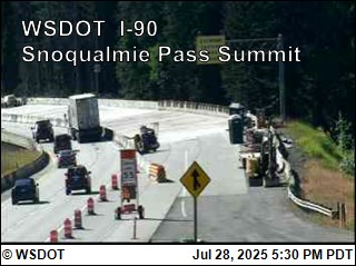
Summit Road Cam
THURSDAY
Nov 27

40° / 36°

4 - 12
mph
 1
1
FRIDAY
Nov 28
39° / 33°
7 - 15
mph
0
SATURDAY
Nov 29

36° / 28°
5 - 13
mph
1
SUNDAY
Nov 30
37° / 32°
0 - 0
mph
0
MONDAY
Dec 1
36° / 32°
5 - 12
mph
3
TUESDAY
Dec 2
34° / 31°
5 - 12
mph
4
WEDNESDAY
Dec 3
36° / 30°
5 - 12
mph
0
Cloudy becoming mostly clear overnight continuing through overnight, with periods of snow expected at any time.
Light snow through the day and into overnight. Snowfall is forecast to be a trace amount during the day, and a trace amount in the evening and overnight.
Potential Precip:
0.2 to 1.02
Hi: 40°Low: 36°
5,007 feet to 6383 feet
Winds variable at 4 to 12 mph through the day, becoming variable at 5 to 12 mph overnight.
Partly cloudy becoming cloudy in the late morning continuing through overnight, with periods of snow expected overnight.
Light snow overnight. Snowfall is forecast to be a trace amount overnight.
Potential Precip:
0.03 to 0.17
Hi: 39°Low: 33°
3,736 feet to 7753 feet
Winds variable at 4 to 12 mph in the morning, becoming SE at 7 to 15 mph in the afternoon, and then variable at 5 to 13 mph overnight.
Mostly cloudy becoming clear at times and then partly cloudy overnight. Periods of snow are expected in the morning.
Scattered snow showers possible.
Potential Precip:
0.05 to 0.25
Hi: 36°Low: 28°
1,462 feet to 4300 feet
Winds variable at 4 to 12 mph in the morning, becoming variable at 5 to 13 mph in the afternoon, and then variable at 5 to 12 mph overnight.
Mostly clear becoming mostly cloudy in the afternoon continuing through overnight, with windy conditions at times.
No snow.
No precipitation expected.
Hi: 37°Low: 32°
3,442 feet to 18896 feet
Winds calm through the day, becoming variable at 5 to 12 mph overnight.
Mostly cloudy becoming cloudy in the late morning continuing through overnight, with periods of snow expected at any time.
Periods of light snow throughout the day, moderate at times overnight. Snowfall is forecast to be 3 to 5 inches.
Potential Precip:
0.22 to 1.08
Hi: 36°Low: 32°
3,696 feet to 8992 feet
Winds variable at 5 to 12 mph throughout the day and into overnight.
Cloudy becoming partly cloudy in the evening continuing through overnight, with periods of snow expected at any time.
Periods of moderate to heavy snow throughout the day, light at times overnight. Snowfall is forecast to be 3 to 6 inches.
Potential Precip:
0.25 to 1.24
Hi: 34°Low: 31°
2,937 feet to 3779 feet
Winds variable at 5 to 12 mph through the day, becoming variable at 3 to 10 mph overnight.
Partly cloudy becoming mostly clear at times and then partly cloudy overnight. Expect windy conditions at times.
No snow.
No precipitation expected.
Hi: 36°Low: 30°
1,003 feet to 9191 feet
Winds variable at 5 to 12 mph through the day, becoming variable at 4 to 11 mph overnight.
 Sunrise & Sunset

Lunar Calendar


 Snow Maps and Weather Stations in the Area
 ![]() 2 - 5in, past 72 hours. Snow surface is powder and packed powder
2 - 5in, past 72 hours. Snow surface is powder and packed powder
Snow report provided by SnoCountry
 Mid-Mountain


