 Matsuyama
  Aspen Mounta... Tengendai Kogen
  Whakapapa Sk...
 Snow Farm
  WebCams
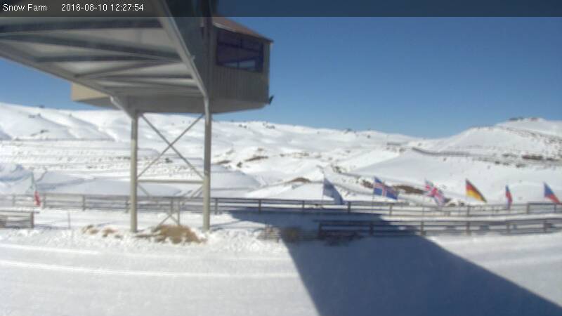
Snow Farm NZ
SATURDAY
Jul 19

32° / 28°

6 - 14
mph
 0
0
SUNDAY
Jul 20

36° / 33°
4 - 12
mph
0
MONDAY
Jul 21
35° / 27°
8 - 16
mph
0
TUESDAY
Jul 22
36° / 26°
5 - 12
mph
0
WEDNESDAY
Jul 23

40° / 36°
4 - 11
mph
0
THURSDAY
Jul 24
40° / 38°
4 - 12
mph
0
FRIDAY
Jul 25
38° / 35°
5 - 13
mph
0
Mostly cloudy becoming clear in the evening continuing through overnight, with periods of snow expected in the afternoon.
Periods of light snow during the day. Snowfall is forecast to be a trace amount during the day.
Potential Precip:
0 to 0.01
Hi: 32°Low: 28°
3,407 feet to 4931 feet
Winds NW at 8 to 16 mph in the morning, becoming W at 6 to 14 mph in the afternoon, and then variable at 4 to 12 mph overnight.
Clear becoming mostly cloudy at times continuing through overnight, with windy conditions at times.
No snow.
No precipitation expected.
Hi: 36°Low: 33°
3,984 feet to 6519 feet
Winds variable at 4 to 11 mph in the morning, becoming variable at 4 to 12 mph in the afternoon, and then variable at 5 to 13 mph overnight.
Partly cloudy becoming cloudy at times and then mostly cloudy overnight. Periods of snow are expected in the evening through overnight.
Light snow in the evening through overnight. Snowfall is forecast to be a trace amount in the evening and overnight.
Potential Precip:
0.01 to 0.05
Hi: 35°Low: 27°
3,223 feet to 6298 feet
Winds NW at 7 to 15 mph in the morning, becoming NW at 8 to 16 mph in the afternoon, and then variable at 5 to 13 mph overnight.
Partly cloudy becoming clear at times continuing through overnight. Expect windy conditions at times.
No snow.
No precipitation expected.
Hi: 36°Low: 26°
3,079 feet to 6479 feet
Winds variable at 4 to 12 mph in the morning, becoming variable at 5 to 12 mph in the afternoon, and then variable at 4 to 12 mph overnight.
Clear through the day and overnight, with windy conditions at times.
No snow.
No precipitation expected.
Hi: 40°Low: 36°
6,507 feet to 7406 feet
Winds variable at 4 to 11 mph through the day, becoming variable at 5 to 12 mph overnight.
Clear through the day and overnight, with windy conditions at times.
No snow.
No precipitation expected.
Hi: 40°Low: 38°
5,445 feet to 7450 feet
Winds variable at 4 to 12 mph through the day, becoming variable at 5 to 13 mph overnight.
Clear through the day and overnight, with windy conditions at times.
No snow.
No precipitation expected.
Hi: 38°Low: 35°
6,320 feet to 6910 feet
Winds variable at 5 to 13 mph through the day, becoming variable at 4 to 12 mph overnight.
 Sunrise & Sunset

Lunar Calendar


 Mid-Mountain


